There is a high chance that Tropical Storm, or perhaps, Hurricane Bonnie, is on the way in the Atlantic; that assessment is based on the National Hurricane Center’s (NHC) latest Tropical Outlook, which has boosted odds of tropical cyclone formation this week to 70% for an area of disturbed weather moving closer to the Windward Islands.
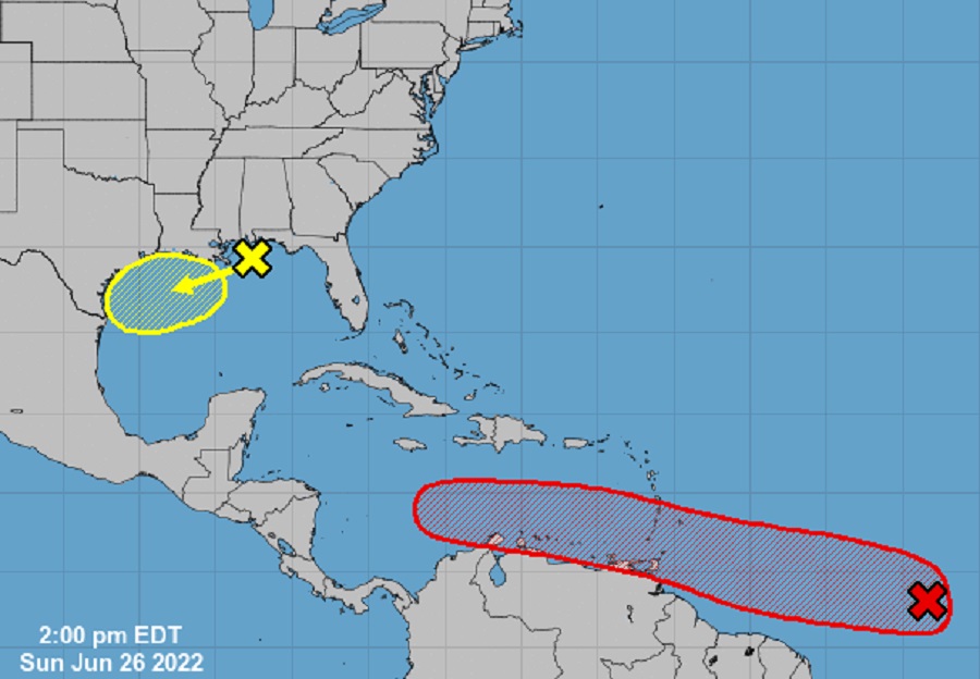
The area of concern is shower and thunderstorm area associated with a tropical wave roughly 1,000 miles east-southeast of the Windward Islands. According to the NHC, the system, which is an environment favorable for further organizations, is showing signs of organization. “A tropical depression is likely to form during the early to the middle part of this week,” said the NHC in their latest Tropical Outlook. This system is forecast to move westward to west-northwestward at 15 to 20 mph over the tropical Atlantic, approach the Windward Islands on Tuesday, and move across the southeastern Caribbean Sea on Wednesday and Thursday. The NHC cautions, “Interests in the Windward Islands should monitor the progress of this system.” There is now a 40% chance that a tropical cyclone will form here over the next 48 hours and a 70% chance that a tropical cyclone will form over the next 5 days.
While the National Hurricane Center hasn’t offered any more specifics beyond their Tropical Outlook, computer forecast guidance suggests rapid development and the possibility of a tropical cyclone forming within the next 24 hours –and perhaps it evolving into a hurricane within 5 days. If the system were to develop into a tropical cyclone and become a named Tropical Storm, it would be called Bonnie.
The NHC is also observing an area of disorganized showers and thunderstorms over the north-central and northeastern Gulf of Mexico. This area of concern is associated with a trough of low pressure. According to the NHC, development of this system is expected to be slow to occur as it drifts westward to west-southwestward across the northern Gulf of Mexico over the next few days. Unlike the system in the Atlantic, the NHC doesn’t expect the Gulf system to take shape this week. In the latest Tropical Outlook, the NHC says there is near zero chance of tropical cyclone development here over the next 48 hours, followed by only a 20% chance for development over the next 5 days.
Elsewhere throughout the entire Atlantic Hurricane Basin, the NHC doesn’t expect any tropical cyclone formation over the next 5 days.
The 2022 Atlantic Hurricane Season began on June 1 and continues through to the end of November.
