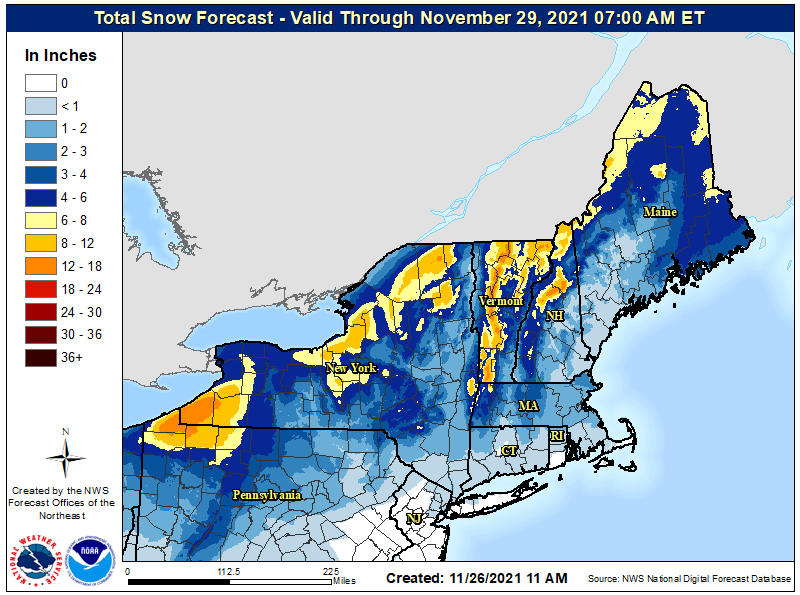
The Thanksgiving Holiday weekend will end and the new work week will begin with some light snow across portions of the northeast. While most snow will be in the 1-3″ range, there will be some areas with heavier, lake-enhanced snow across western portions of New York state, northwestern Pennsylvania down-wind of Lake Erie, and the higher terrain of northern Vermont, New Hampshire, and Maine.
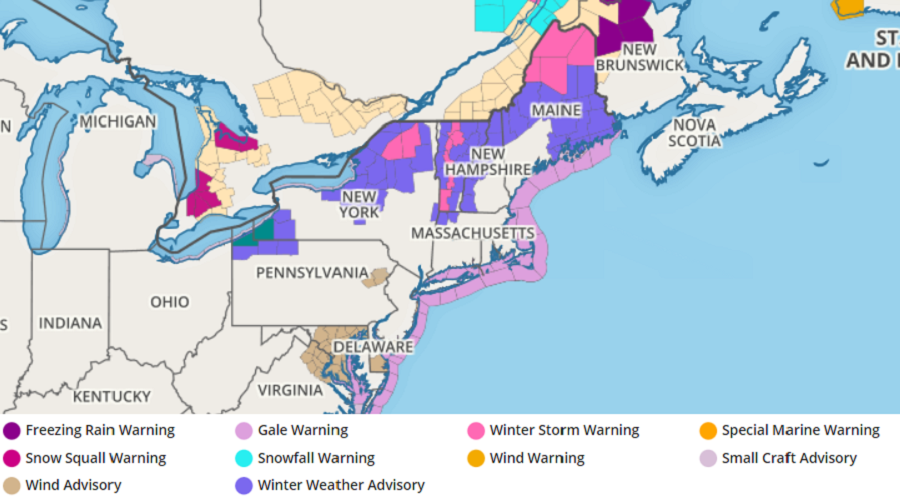
With the snow arriving on a busy travel period, the National Weather Service has issued advisories and warnings for areas that will be impacted the most. Winter Weather Advisories are up for portions of Pennsylvania, New York, New Hampshire, Vermont, and Maine. Winter Storm Warnings are up for portions of northern New York, the higher terrain of Vermont, and northern Maine where more than 6″ of snow could fall.
While snow showers or flurries are possible as far south as Philadelphia and New York, no accumulations are expected there. Boston could see a light dusting; however, the better chance for more substantial accumulations of snow will be well north and west of the city.
A weak surface low is forecast to track across the northeast on Sunday; a secondary low is forecast to develop and move across Maryland, Delaware and southern New Jersey on Sunday afternoon, with the National Weather Service suggesting that the whole system will regroup off of southeastern New England late Sunday night into early Monday.
Prior to regrouping off the coast, the initial disturbance should bring light snow to a region stretching from northeastern Wisconsin and Michigan down into Pennsylvania, New York, and the northern half of New Jersey. As the system organizes off the New England coast and brings a little more moisture into the system, some light rain or a light wintry mix is possible on the southern side of the system in portions of Pennsylvania and New Jersey before the system exits on Monday.
As cold advection begins again on Sunday night, some lingering snow showers are possible north and west of the I-95 corridor. Any remaining rain showers could change to light snow showers on the southern side of the snow, but no additional accumulations are expected there.
