The National Hurricane Center (NHC) in Miami Florida is watching two areas of concern for possible tropical cyclone formation: one is off the U.S. East Coast, the other is in the Gulf of Mexico. Development that occurs at either location will be slow. The National Hurricane Center has addressed each of these two systems in their latest Tropical Outlook.
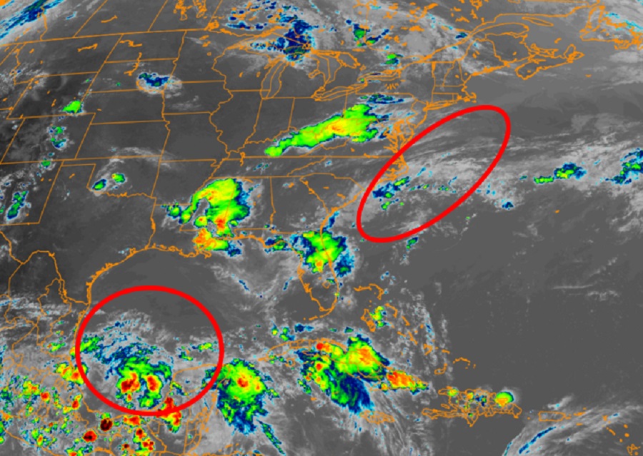
The area with the best chance of development is over the southern Gulf of Mexico. A large area of showers and thunderstorms over the Bay of Campeche is associated with a broad low pressure area. According to the National Hurricane Center, the overall system has become somewhat better organized since yesterday and slow development is possible during the next few days while the system meanders near the coast of Mexico. While the odds of tropical cyclone formation here are now up to 50%, the National Hurricane Center believes a tropical depression could form late in the week while the system begins to move slowly northward towards the U.S. coast. Even if the system doesn’t develop into a tropical cyclone, heavy rainfall is possible over portions of Central America and southern Mexico during the next several days.
The next area of concern is along the U.S. East Coast off the Carolina coastline. According to the NHC, a non-tropical area of low pressure has formed about 150 miles south of Wilmington, North Carolina. It is currently producing disorganized showers and thunderstorms. This system is forecast by the NHC to move northeastward for the next few days near the warm Gulf Stream, which could allow for some tropical development to occur while it moves away from the United States. However, this low pressure system should move over colder waters south of Nova Scotia by midweek, ending its development
possibilities. Here, the NHC believes there’s only a 20% chance of tropical cyclone formation over the next 5 days.
Elsewhere, the NHC doesn’t expect any tropical cyclone formation elsewhere in the Atlantic hurricane basin.
The 2021 Atlantic Hurricane Season began on June 1 and runs through to the end of November. Typically, mid-September is the peak of hurricane season in this basin.
