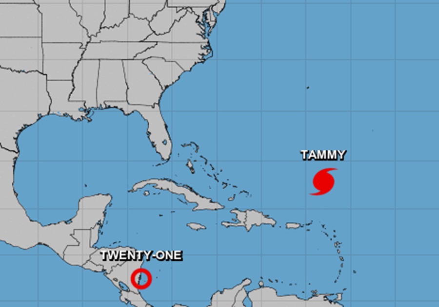
The National Hurricane Center (NHC) in Miami, Florida is busy tracking two systems: Hurricane Tammy northeast of Puerto Rico in the Atlantic Ocean and newly formed Tropical Depression #21 located near Honduras in Central America. Tammy is forecast to have an unusual track that curves out over the Atlantic and back towards the southeastern United States while the tropical depression is forecast to move inland and not develop further.
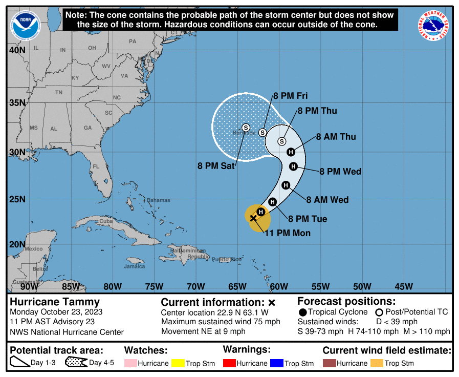
As of the latest advisory from the NHC, Hurricane Tammy had maximum sustained winds of 75 mph and was 655 miles south of Bermuda. The storm is moving to the northeast at 9 mph. The minimum central pressure is 987 mb or 29.15″.
While Tammy is moving toward the northeast near 7 mph now and is expected to continue to do so through Wednesday, a turn toward the north at a slower forward speed is forecast to begin on Thursday. The official NHC forecast also curves the storm west, bringing it near Bermuda by the end of the week or early next weekend. Slight strengthening is possible during the next day or two but then the NHC says weakening is expected after that. Tammy is currently forecast to become a post-tropical cyclone on Thursday.
There are no Hurricane Watches or Warnings for Tammy in effect at this time. However, swells generated by Tammy will continue to affect portions of the Leeward Islands, the British and U.S. Virgin Islands, and Puerto Rico during the next few days, prompting surf-related advisories to be issued. These swells are likely to cause life-threatening surf and rip current conditions; even expert swimmers and surfers are advised to avoid the water until the threats from Tammy pass.
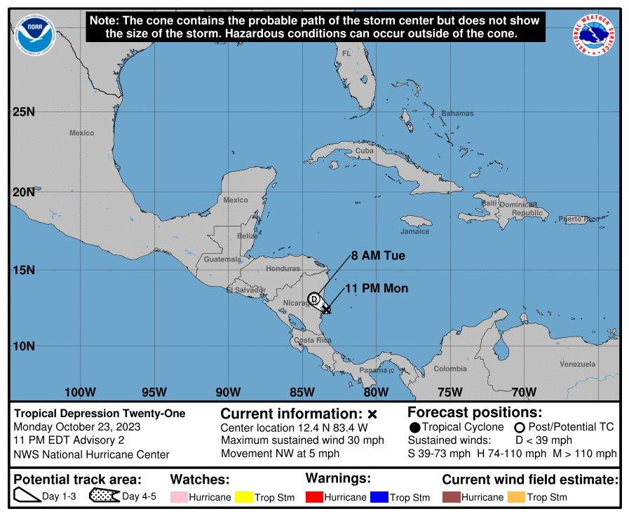
Meanwhile, a new system formed off the east coast of Central America. Known as Tropical Depression #21, the storm is located 40 miles northeast of Bluefields, Nicaragua. The depression is moving toward the northwest near 5 mph and this motion is expected to continue tonight. On the forecast track, the depression will move inland over eastern Nicaragua very soon. Maximum sustained winds are near 30 mph with higher gusts. Little change in strength is forecast. The depression is forecast to dissipate inland over Nicaragua tomorrow.
The tropical depression is expected to produce additional rainfall totals of 4-8″ with maximum amounts of 12″ across Nicaragua and 2-4″ with maximum amounts of 6″ across southern and eastern Honduras. These rains are likely to
produce flash and urban flooding, along with mudslides in areas of higher terrain.
