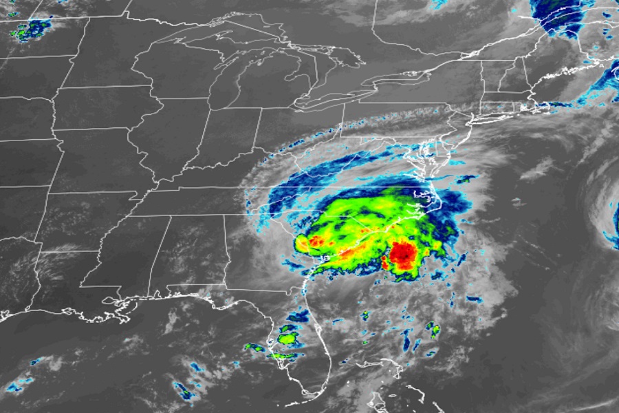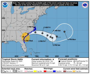
The National Hurricane Center has downgraded once-major Hurricane Idalia down to Tropical Storm status, with the storm now located about 40 miles west of Savannah, Georgia. While the storm struck Florida with 125 mph after briefly strengthening to a 130 mph category 4, it is still bringing fresh water flooding, storm surge, and strong winds across portions of Georgia and the Carolinas.
Tropical Storm Idalia now has maximum sustained winds of 70 mph and is moving northeast at 21 mph. The minimum central pressure is up to 984 mb or 29.06″.
The Storm Surge Warnings and Watches that were in effect have been discontinued along the Gulf coast of Florida. The Storm Surge Watch has been discontinued along the Georgia coast. The Hurricane Warning along the coasts of Georgia and South Carolina has been changed to a Tropical Storm Warning. The Hurricane Watches have been discontinued. The Tropical Storm Warnings have been discontinued along the Gulf coast of Florida, and on the east coast of Florida south of the Flagler/Volusia County Line.
A Storm Surge Warning remains in effect from St. Catherine’s Sound, Georgia to South Santee River, South Carolina. A Tropical Storm Warning is in effect for the area from the Volusia/Brevard County Line Florida to the North Carolina/Virginia border as well as the Pamlico and Albemarle Sounds.
No watches are currently in effect for Bermuda, but the National Hurricane Center warns that interests there should monitor the progress of Idalia.

The National Hurricane Center expects Idalia to continue to move north through tonight. A generally eastward motion is forecast to begin on Thursday and continue through Saturday. On the forecast track, the center of Idalia will move near or along the coasts of Georgia and South Carolina through tonight, and then just offshore the coast of North Carolina on Thursday. Idalia will then move eastward over the western Atlantic into the weekend.
While the storm will continue to weaken, it is still bringing significant storm surge of up to 3-5′ in the Storm Surge Warning area. The deepest water will occur along the immediate coast in areas of onshore winds, where the surge will be accompanied by large waves. Surge-related flooding depends on the relative timing of the surge and the tidal cycle, and can vary greatly over short distances.
Tropical storm force wind conditions are occurring within the tropical storm warning area along the northeastern coast of Florida, Georgia, and South Carolina, and will spread across coastal sections of North Carolina tonight through Thursday.
Idalia is expected to produce a swath of 4-8″ of rainfall with isolated amounts up to 10″ from east-central Georgia through central to eastern South Carolina and eastern North Carolina into Thursday. These rainfall amounts will lead to areas of flash, urban, and moderate river flooding, with considerable impacts. The trailing moisture band from Idalia has the potential to produce additional rainfall amounts of 1-2″ across the west coast of Florida.
A few tornadoes will be possible through this evening across coastal South Carolina and through tonight across southern coastal North Carolina. Tornado Warnings are being issued where tornadic cells materialize.