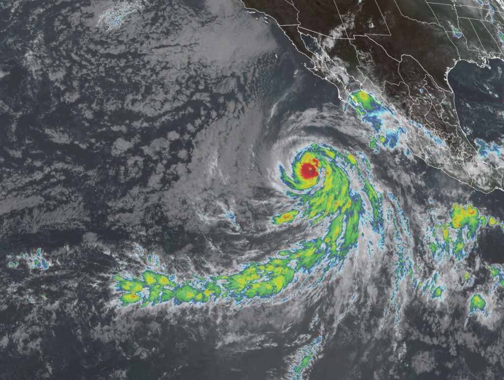
Hurricane Jova rapidly intensified into a Category 5 hurricane on the Saffir-Simpson hurricane wind scale yesterday, but is now forecast to weaken as it travels harmlessly into the open waters of the Pacific between Hawaii and California. Earlier this morning, winds inside Jova were sustained up to 160 mph, making it a chart-topping major hurricane. Now winds have diminished slightly to 155 mph, making it a Category 4 hurricane just below the 157 mph threshold for category 5 status.
As of the latest advisory from the National Hurricane Center in Miami, Florida, Jova was located about 550 miles southwest of the southern tip of Baja California. Maximum sustained winds are at 155 mph while the minimum central pressure is down to 932 mb or 27.53″. The storm is moving to the west-northwest at 16 mph.
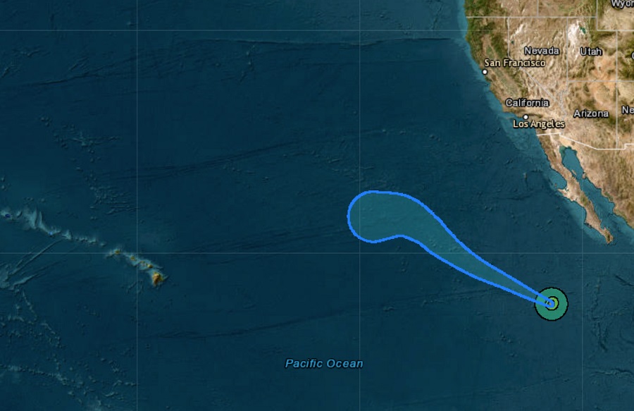
According to the National Hurricane Center, the storm should continue marching west-northwest for the next few days. Some fluctuations in intensity are possible today and the storm could increase back to a category 5 hurricane. However, weakening is forecast to begin late tonight and continue through the weekend.
The storm will remain over open waters of the Pacific and is not forecast to bring direct impacts to the U.S. West Coast or Hawaii at this time.
