Hurricane Ian, a rather large storm, is forecast to quickly break-down and dissipate after it makes landfall on the South Carolina coast today. Hurricane force winds extend out 70 miles from the center of the storm while tropical storm force winds extend more than 270 miles out from the center.
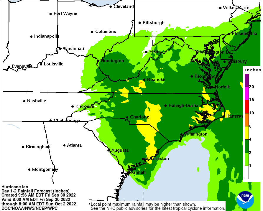
While Ian is forecast to lose much of its tropical cyclone characteristics after landfall, it will still pack quite a punch in terms of lingering gusty winds and heavy rain showers. Tropical storm force wind gusts will be possible throughout the southern and central Mid Atlantic area, especially over the coastal plain. Heavy rains of 4-6″ could fall across portions of South and North Carolina and Virginia, creating flooding issues there.
Overall, the National Hurricane Center (NHC) remains concerned over 3-key areas this afternoon: storm surge, hurricane force wind gusts, and river flooding.

According to the NHC, there is a danger of life-threatening storm surge today along the coasts of the Carolinas within the Storm Surge Warning areas. Storm surge could be upwards of 4-7′, especially with Ian making landfall at the time of high tide. This could create life-threatening conditions along the Storm Surge warning area, with damage similar to what was seen in Florida possible here.
Hurricane-force winds are expected along the coasts of South Carolina and southeastern North Carolina within the Hurricane Warning area soon. Hurricane conditions are possible in North Carolina within the Hurricane Watch area by this afternoon. The NHC says that preparations should be rushed to completion ahead of the storm’s arrival.
The NHC also says that ongoing major-to-record river flooding will continue through next week across portions of central Florida. Considerable flooding is expected today across portions of coastal and northeast South Carolina, coastal North Carolina and southeast Virginia. Locally considerable flooding is possible across portions of northwest North Carolina and southern Virginia today into early Saturday
