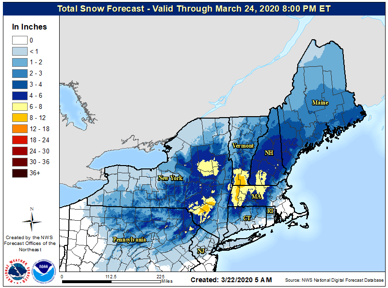
While spring is officially here, Old Man Winter isn’t quite done visiting in the northeast. High pressure will build in from southeast Canada today with sunny, fair and cold conditions across much of the northeastern United States. Clouds will increase tonight ahead of the next storm system which will bring snow and rain to region to kick-off the new. Most of eastern New York and western New England will receive accumulating snow as the coastal storm moves away from New England Monday night.
The National Weather Service expects upwards of 8-10″ of snow in portions of eastern New York, southern Vermont and New Hampshire, and central and western Massachusetts. Much less is expected further south, where only a light dusting is expected over central Pennsylvania and northern New Jersey. While snowflakes are likely to fly for a period of time over New York City and much of Long Island, nothing more than a dusting of snow on grassy surfaces is expected there. Due to the accumulations forecast, the National Weather Service has issued Winter Weather Advisories where light snow is possible and has posted Winter Storm Watches in areas where heavier snow is possible.
Snow that does fall will be on the wet, heavy side; this has the potential to knock down tree branches or wires which could lead to power outages. With mandatory lock-downs, quarantines, and other shelter-in-place procedures in place in this area due to the COVID-19 pandemic, it may take time for power to be returned to areas that lose it.