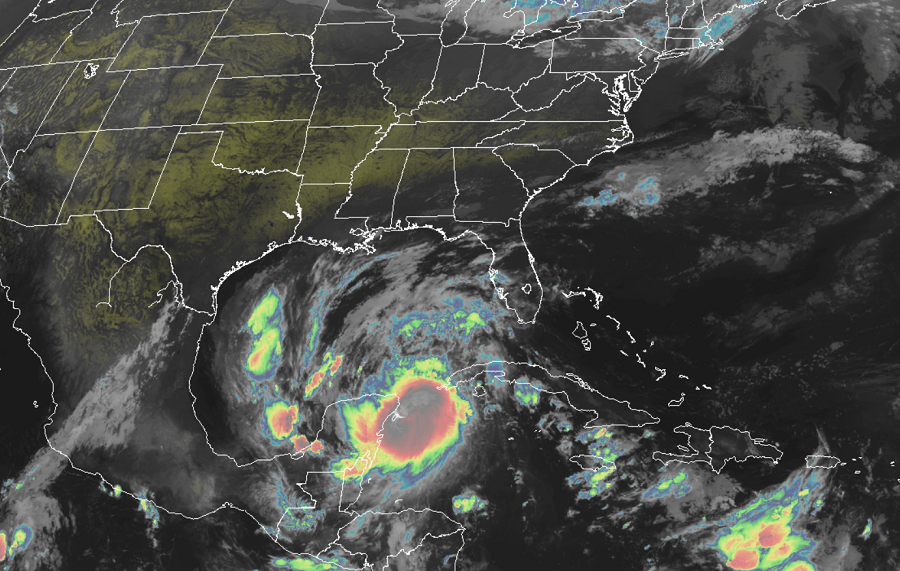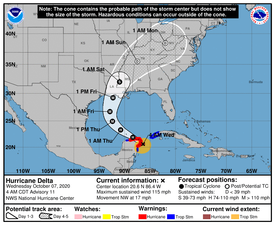
For yet another time this busy hurricane season, a major hurricane landfall appears likely on the Louisiana coast later this week, with the current forecast track close to where Major Hurricane Laura struck earlier this season in late August. While the precise place of impact isn’t yet known, people across the central Gulf Coast should prepare for severe impacts that could arrive as soon as Friday. Due to that threat, the National Hurricane Center is expected to begin to issue Hurricane Watches and Storm Surge Watches for portions of the coast today.
As of the latest advisory from the National Hurricane Center, Major Hurricane Delta was located about 35 miles east-northeast of Cozumel, Mexico and had maximum sustained winds of 115 mph. The hurricane is moving to the northwest at 17 mph. The estimated minimum central pressure is 972 mb or 28.71 inches.
The forecast track from the National Hurricane Center is an ominous one. A west-northwestward to northwestward motion is expected over the next day or so with a slower northwestward to north-northwestward motion is forecast to begin on Thursday. By Thursday night and Friday, Delta should head due north. On the forecast track, the center of Delta will move over the northeastern portion of the Yucatan Peninsula during the next few hours. Delta is then forecast to move over the southern Gulf of Mexico this afternoon, be over the southern or central Gulf of Mexico through Thursday, and approach the northern Gulf coast on Friday.

The National Hurricane Center says that although some weakening is likely when Delta moves over the Yucatan peninsula, re-strengthening is forecast when the hurricane moves over the southern Gulf of Mexico Wednesday night and Thursday, and Delta could become a category 4 hurricane again by
late Thursday.
Before Delta arrives on the U.S. Coast, it will bring horrific storm surge, destructive winds, and flooding rains to portions of Mexico. A life-threatening storm surge will raise water levels in areas of onshore winds by as much as 8-12 feet above normal tide levels along the northern coast of the Yucatan Peninsula from Cabo Catoche to Progresso. Near the coast, the surge will be accompanied by large and destructive waves. In the Yucatan Peninsula, extremely dangerous hurricane wind conditions are expected in portions of the warning area during the next few hours, with tropical storm conditions already occurring. Tropical storm conditions are expected in the tropical storm warning area to continue for the next several hours. In Cuba, tropical storm conditions are expected during the next few hours. Through early Thursday, Delta is expected to produce 4-6″ of rain, with isolated maximum totals of 10″, across portions of the northern Yucatan Peninsula. This rainfall may result in areas of significant flash flooding.