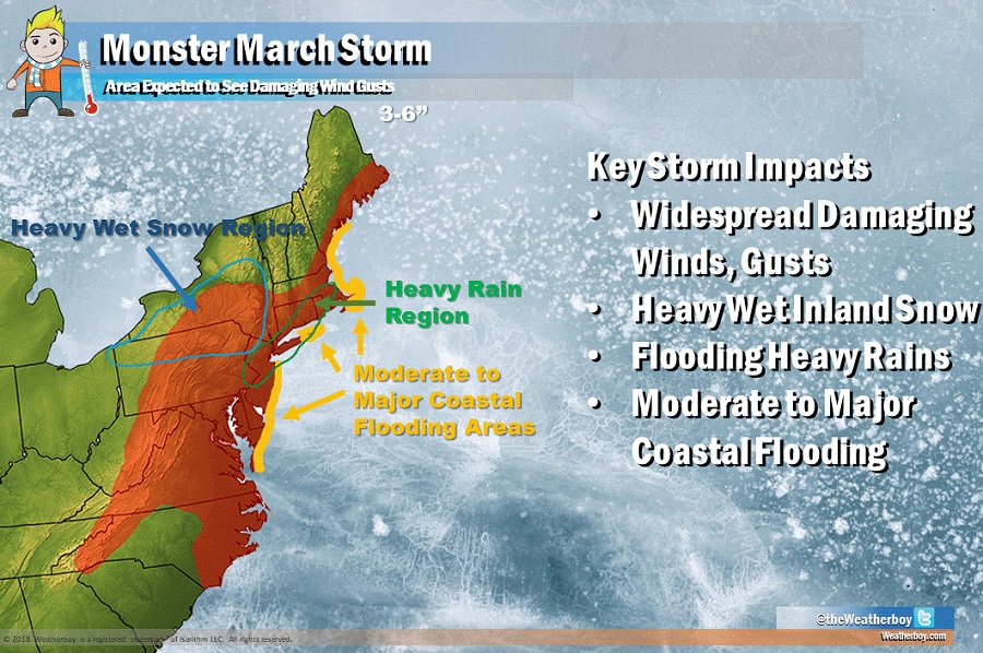
A monster March storm is forecast to pound the northeast with record-breaking coastal flooding, heavy precipitation, and destructive winds. People from Maryland to Maine are being told to prepare for impact and to take necessary steps to protect life and property ahead of the storm.
As a surface low in the central plains this morning moves through the Ohio Valley into Pennsylvania tonight, a second low in the Southeast will progress northeast off the Mid-Atlantic coast. The Pennsylvania low will weaken as the coastal storm stalls and intensifies rapidly Friday and Friday night. It is the rapidly intensifying low pressure system that will become the Monster March Storm. Over time, the low will move out to sea over the weekend as high pressure noses southward into the eastern US.
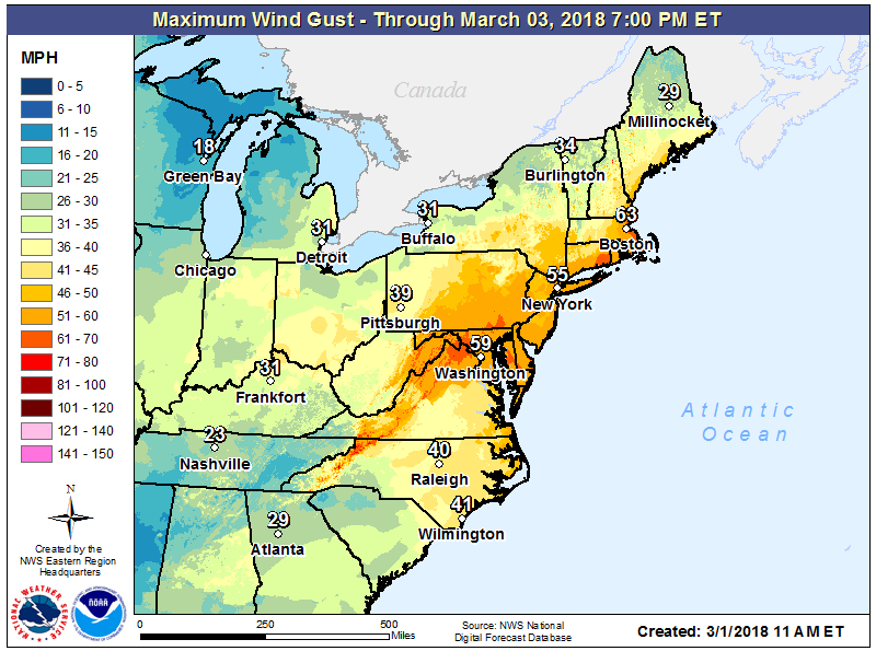
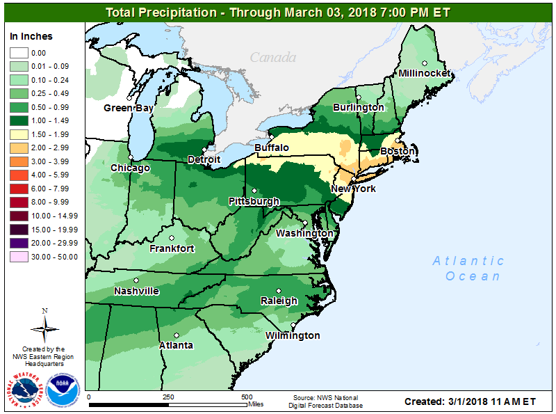
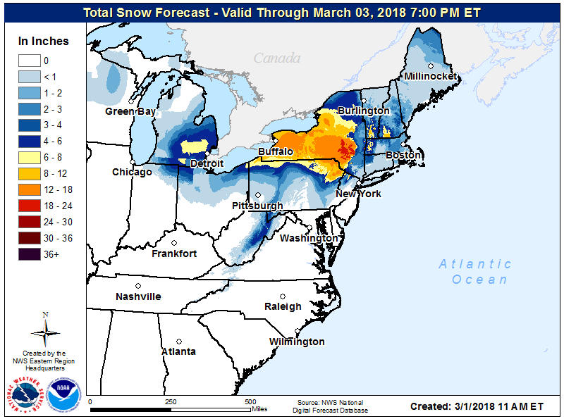
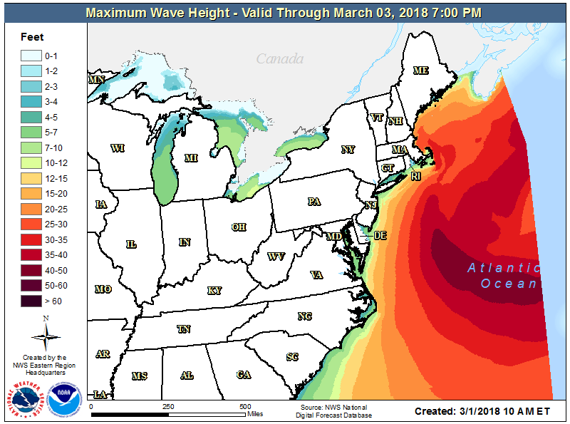
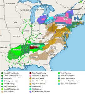
The storm system’s worst impact may be the coastal storm flooding threat. In places like Boston, MA and Atlantic City, NJ, coastal flooding may meet or exceed historic maximums. Residents in coastal flood prone areas should prepare to head to higher, inland ground before conditions deteriorate.
While people will be able to recover on Sunday from the impacts of the storm, that recovery time will be brief. It appears at least one, and perhaps two, additional storms will impact the northeast next week. Those additional storms may have more cold air to work with, resulting in more snow than rain than this Monster March storm has.