
Forecasters with the National Weather Service are calling for a hot mess in New Jersey and Pennsylvania , where thunderstorms could produce damaging wind gusts and torrential heavy rains, the potential exists for more flash flooding, and the heat index should soar into the low 100’s as uncomfortable amounts of heat and humidity blanket the area.
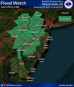
Due to the flood threat, the National Weather Service has issued a Flood Watch for much of eastern Pennsylvania and western New Jersey beginning at 3pm today. This same area was hit hard by flash flooding two nights ago where flood waters claimed the lives of two in New Jersey.
“Turn around, don’t drown! Never drive through flood waters,” cautions the National Weather Service.
A very warm and humid airmass will be over the region through Thursday with multiple rounds of showers and thunderstorms expected. A frontal boundary will remain stalled across the northern portion of the Mid Atlantic today before lifting north of the area as a warm front on Thursday. A cold front will pass through the region Thursday night into Friday, with high pressure building in for Saturday and bringing an end to the humid, moist, and hot weather pattern for now.
Before the break through, severe thunderstorms are possible –both in pop-up form today, and more organized tomorrow as the cold front moves through the region. Thunderstorms may have strong to severe wind gusts over 50 mph which could knock down trees and powerlines. Severe Thunderstorm Warnings could be issued for counties impacted by these storms.
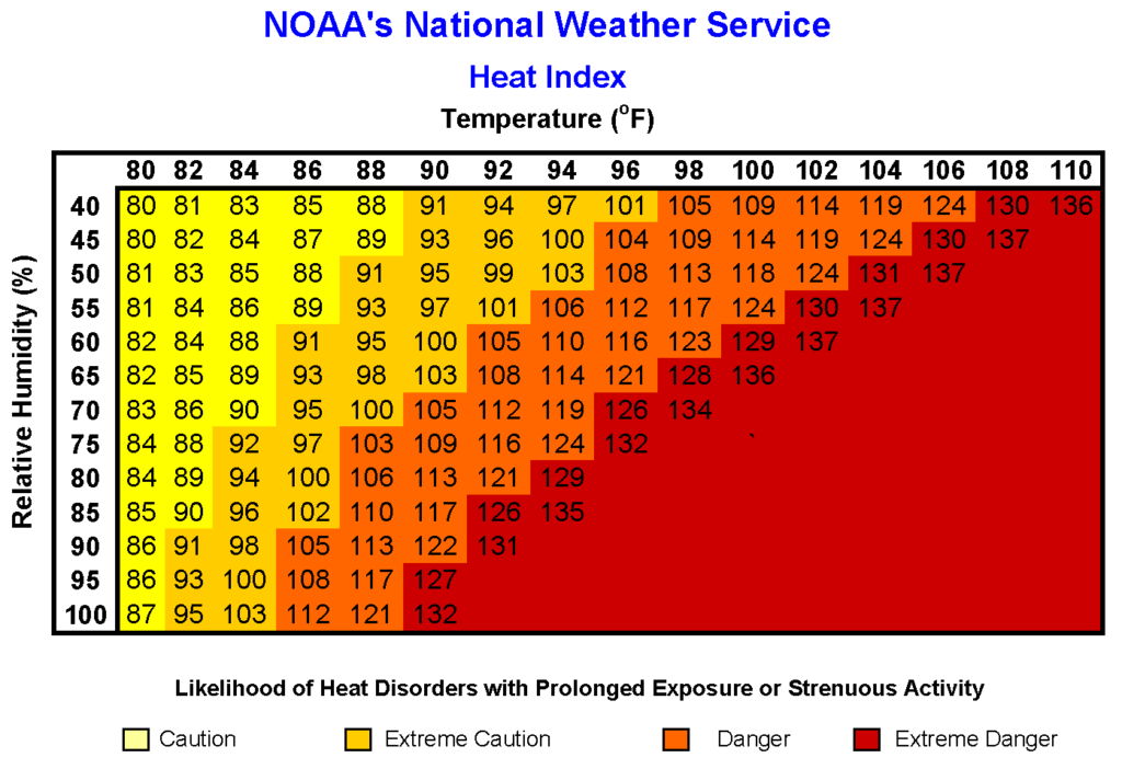
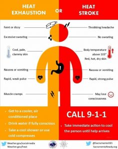
The combination of heat and humidity will make it extremely uncomfortable and outright dangerous tomorrow. Southwest return flow will strengthen Thursday ahead of the frontal boundary, which will help push temperatures and dewpoints up a few degrees from earlier in the week. Forecast high temperatures are in the upper 80s to lower 90s across much of New Jersey and Pennsylvania. Dewpoints will generally be in the mid 70s, which will make for oppressively hot and humid conditions with heat indices near 100-105 across much of the area outside the higher elevations northwest. Even the immediate coast and beaches will not be immune from the oppressive humidity.
Ocean water temperatures are in the mid 70s to near 80 degrees. While temperatures may be a few degrees cooler at the coast, dewpoints will be higher resulting in heat indices in the 100-105 degree range, especially earlier in the day before the sea breeze gets stronger.
With extreme heat and humidity, a Heat Advisory is in effect for much of the region.
