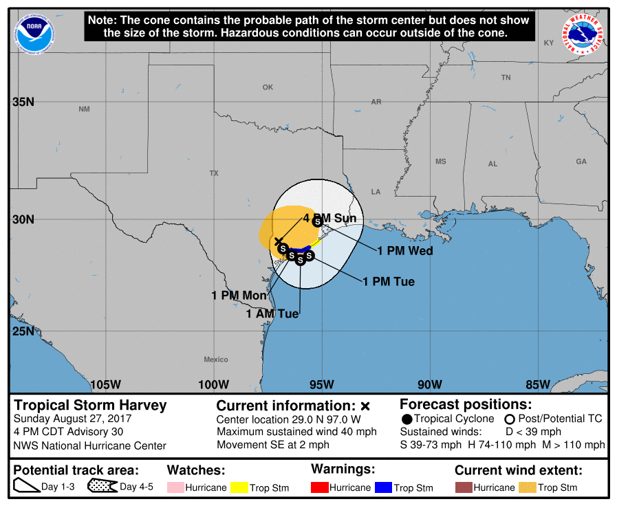
While it doesn’t seem possible for conditions to get worse in Texas, they are; the National Hurricane Center has issued new watches for Harvey. Harvey’s center of circulation is expected to return to the Gulf of Mexico, allowing it to pick up additional strength and moisture. As a result of this new forecast path, the National Hurricane Center has extended Tropical Storm Watches further east. A Tropical Storm Watch has now been issued for the coast of Texas from north of Sargent to San Luis Pass; this is in addition to the Tropical Storm Warning that is in effect for Port O’Connor to Sargent, Texas.
The unprecedented flooding rainfall event continues to unfold over a large area of southeastern Texas. While Harvey has been moving slowly eastward or east-southeastward today, bands of heavy rainfall have continued to form over the northwestern Gulf and train inland over much of the upper Texas coast and southwestern Louisiana. Storm total rainfall amounts in the 20-27 inch range are quite common in the Greater Houston area, and additional rainfall amounts of 15 to 25 inches are expected over the next several days. Rainfall total could reach 50 inches in some locations, which would be historic for that area.
Harvey is still producing tropical-storm-force winds, with a recent observation of 34 kt with a gust to 46 kt at New Braunfels, Texas.
The NHC track guidance is in better agreement showing Harvey moving just offshore of the Texas coast on Monday, then turning northward and moving inland over northeastern Texas by 72 hours. All of the global models show some slight deepening of the system after it moves over water, but given the lack of an inner core, significant strengthening is not anticipated. Although a tropical storm watch has been issued, which may need to be extended eastward along the upper Texas and southwest Louisiana coast tonight, heavy rainfall and life-threatening flooding continue to the primary threats.
With the system spinning about over the Gulf, there will be a persistent threat of tornadoes across eastern Texas, the Houston Metro area, and southern Louisiana. People who did not flee the storm will need to balance the life-threatening risks dangerous tornadoes and rising flood waters have on how to deal with this emergency.
