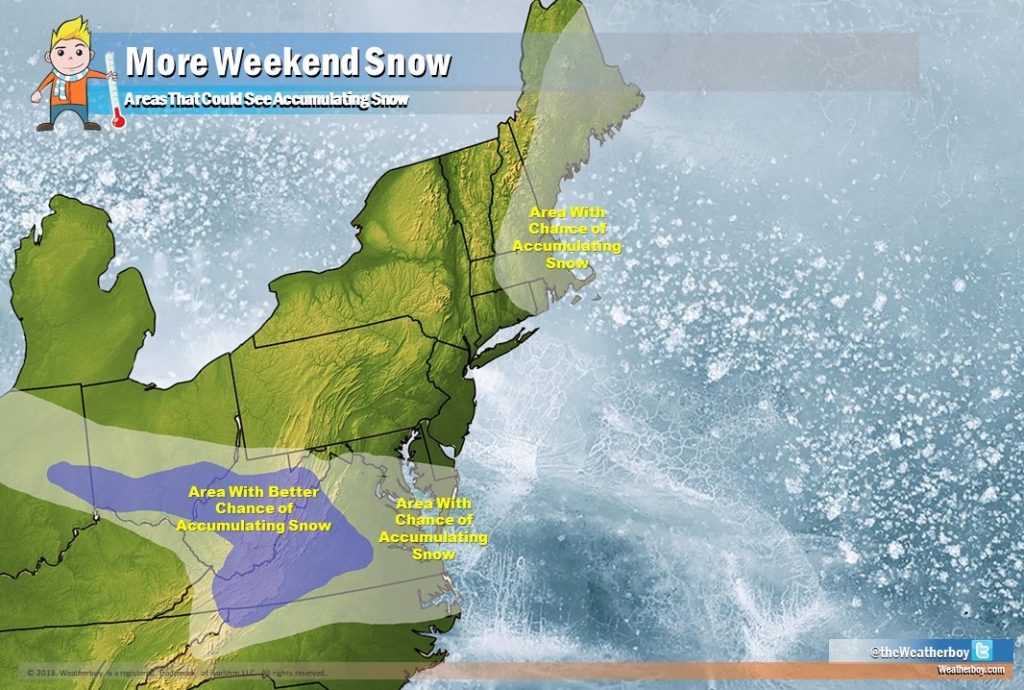
While portions of the northern Mid Atlantic dig out from more than a foot of snow from yesterday’s potent nor’easter, eyes are on the next winter storm. While the calendar says it’s Spring, it doesn’t look like Old Man Winter is in a hurry to leave. Yet another low pressure system will move to the East Coast, bringing another round of accumulating snow with it. Unlike the four nor’easters that hit this month, this next storm will be a fast-mover that should only impact a small portion of the southern Mid Atlantic. Some additional snow is also expected over eastern New England, but the main event this weekend will likely be over Virginia and West Virginia.
The next system to visit the Mid Atlantic will be arriving from Canada. A strong vorticity maximum will move southward from eastern Canada on Saturday as a separate vorticity maximum moves west to east through the central United States. The related surface low pressure system in the central plains on Saturday should steer south somewhat as it tracks into the Ohio and Tennessee Valleys. High pressure building into the East Coast should be strong enough to blunt this system to the south, but any weakness could allow a more northerly track. When the low nears the coast, it is expected to intensify like all of the nor’easters before it. As long as the lingering high stays strong, the system will shoot out to sea. If the high weakens or the low strengthens enough to curve up the coast, wintry weather could return to an area that likely is tired of it.
With the storm system expected to be moving more south and east than north and east, the area with the best chance of accumulating snow is over West Virginia and western Virginia. Snow could fall as far north as the Washington/Baltimore metro area and across the DelMarVa Peninsula. In the currently unlikely event the storm is able to curve up the coast, the rest of Delaware, Pennsylvania, and New Jersey could see accumulating snow. The exact track and intensity of this storm system will help define snowfall amounts; at this time, it is still too soon to say with a great deal of confidence who will see how much snow.
While that system is moving through the southern Mid Atlantic, an area of low pressure could back-up into eastern New England and bring that area some light snow. While some snow is possible there, it is not directly related to the system expected to impact locations further south.
Once this weekend system exits the coast, strong ridging will build into the northeastern US, giving the area a much needed break from the winter weather. Not only should there be a prolonged dry period, but temperatures should rebound nicely too. However, at that point, meteorologists will again be keeping an eye on the next possible weather maker. If some extended forecast guidance is to be believed, there could be yet another nor’easter impacting the Mid Atlantic and New England coasts. Unlike the four storms before it, though, that Easter Nor’Easter is more likely to be wet than white with a lack of cold air available to produce snow.