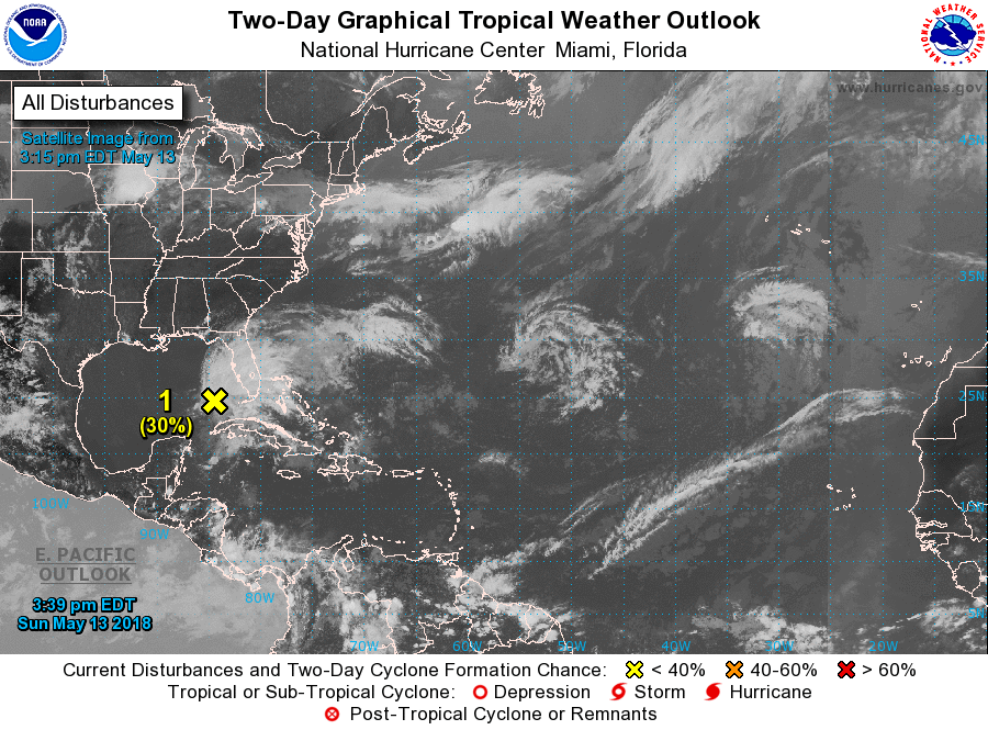
The National Hurricane Center (NHC) has issued a Special Tropical Outlook for a disturbance in the Gulf of Mexico. This was issued shortly after the recent American GFS model run suggested a tropical cyclone could brew in the coming days near Florida. The National Hurricane Center believes there’s a 30% chance over the next 2 days and 40% chance over the next 5 days that a tropical or subtropical cyclone could form here.
In their outlook, the NHC writes, “A large area of cloudiness, showers, and thunderstorms extending from western Cuba across the southeastern Gulf of Mexico, the Florida Straits, and much of the Florida Peninsula is associated with a broad surface low and trough interacting with an upper-level low. This system could acquire some subtropical or tropical characteristics while it moves slowly northward across the eastern Gulf of Mexico during the next few days. Regardless of subtropical or tropical cyclone formation, this system will enhance rainfall across portions of Florida and the northeastern Gulf Coast during the next few days.”
The NHC plans to issue the next Tropical Weather Outlook for this system by 11am ET on Monday.