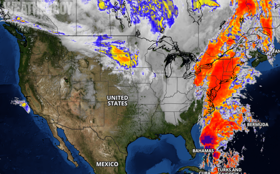
Tropical Storm Philippe and a larger frontal system it is merging with as it becomes extra-tropical is impacting the US East Coast today, bringing heavy rain, damaging winds, and even heavy snow to some.
In the latest advisory from the National Hurricane Center (NHC), the center of Tropical Storm Philippe was located near latitude 27.8 North, longitude 77.5 West. Philippe is moving toward the east-northeast near 31 mph. According to the NHC, motion toward the northeast at a faster forward speed is expected to begin later this afternoon and continue through Monday. On the forecast track, the center of Philippe will continue to move quickly away from the Florida east coast and the northwestern Bahamas and emerge over the open western Atlantic later this afternoon. Maximum sustained winds are near 50 mph with higher gusts. Some slight strengthening is possible during the next day or so. However, Philippe is expected to become a post-tropical cyclone by tonight, and be absorbed by a large extratropical low on Monday.

On this date five years ago, Sandy, also a post-tropical cyclone, made landfall on the New Jersey coast near Atlantic City, bringing destructive storm surge and winds to the Garden State and New York. While Philippe and today’s storm system share the date, there isn’t much else they do share. The structure, size, and duration of both storms are very different and Philippe and the storm it is merging with won’t be anything like Sandy in terms of storm surge or damage.
Nevertheless, today’s storm system will be a potent one and there will be a variety of weather hazards with it. These hazards including damaging winds, heavy rain, and heavy snow.
Winds around the center of Philippe will broaden into the larger storm system it is merging into. Now, tropical storm-force winds from Philippe extend outward up to 195 miles from the center. Recent ship observations continue to indicate that tropical-storm-force winds of 40 to 50 mph are occurring across the waters in and near the northwestern Bahamas. In addition, sustained winds of 35 mph and gusts to 51 mph have been occurring at Settlement Point on the western end of Grand Bahama Island during the past couple of hours.
While Philippe will transform away from a tropical cyclone, the new system will bring tropical storm force winds and hurricane force wind gusts to portions of the Mid Atlantic and Northeast. Sustained winds of at least 25mph will spread as far west as eastern Pennsylvania and eastern upstate New York this evening. At the Jersey Shore, across Long Island, and throughout southern and eastern New England, sustained winds greater than 40mph are possible with gusts to or above 60mph, especially at the immediate coast. Across south eastern New England, some gusts will be in the 60-80mph range. These winds will create power outage problems in the northeast.
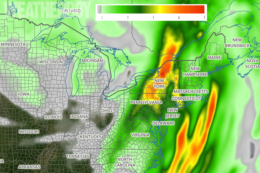
Heavy rain is also expected, especially north of New York City, where more than 3″ of rain will fall over the next 24 hours. Some rain will create localized flash flood issues; people in this region should remember: turn around, don’t drown; never drive through floods.
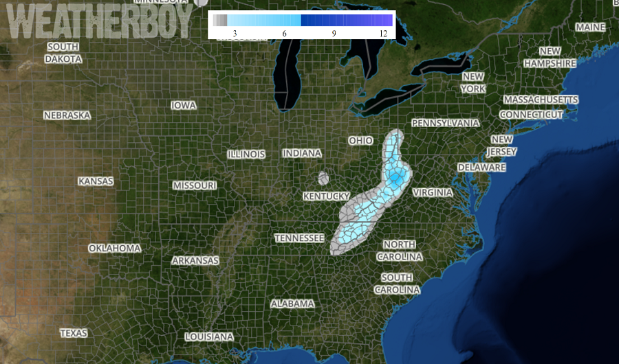
Just enough cold air is available to produce snow on the western fringe of this system. Snow was reported as far south as the northern Georgia mountains this morning; more snow, heavy at times, is expected along the spine of the Appalachians. In the highest elevations of West Virginia, 6″ of more of snow may fall. Lighter accumulations are expected in western North Carolina, Virginia, Maryland, and Pennsylvania.
