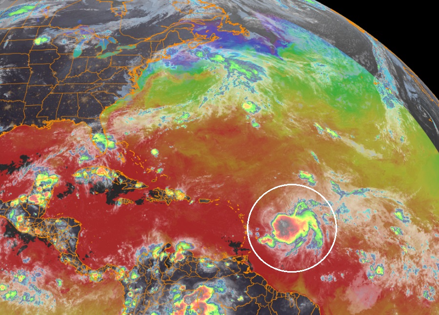
Tropical Storm Philippe is now forecast to take on a weakening Tropical Storm Rina’s remnants along with leftover moisture from what’s left of Tropical Storm Ophelia as it moves up over open waters of the central Atlantic well away from the U.S. East Coast and east of Bermuda.
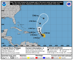
As of the latest advisory from the National Hurricane Center (NHC), Tropical Storm Philippe was located about 455 miles east-southeast of the Northern Leeward Islands and had maximum sustained winds of 50 mph. It was drifting to the southwest at 5 mph with a minimum central pressure of 999 mb or 29.50″.

While Philippe is moving toward the southwest near 5 mph and this general motion is expected through tonight, a turn toward the west-northwest and northwest with an increase in forward speed is expected Sunday and Monday, followed by a northward motion on Tuesday.
Tropical Storm Rina is located north and east of Philippe and is losing steam; the NHC expects it to dissipate in the coming days. Remnant moisture from Rina and what’s left of Ophelia will eventually roll up into Philippe in the coming days.
While maximum sustained winds are near 50 mph with higher gusts in Philippe now, some strengthening is forecast during the next few days, and Philippe could become a hurricane early next week.
Even as a hurricane, no direct impacts are expected in North America from Philippe. Some swells generated by Philippe will affect portions of the Atlantic coasts of the northern Leeward Islands, the Virgin Islands, and Puerto Rico through early next week, but nothing worse than that is expected there. Nevertheless, the swells can be dangerous and can cause life-threatening surf and rip current conditions.