Old Man Winter has been tough to leave even though Spring officially arrived last week; between the fourth nor’easter of the month in the northeastern United States last week and the blizzard that brought 80mph+ winds and heavy snow to Hawaii this weekend, it hasn’t felt like spring too much outside across the US. To make matters worse for those looking for milder conditions, it appears the Polar Vortex will be making a rare appearance for the early part of next month.
Well above the surface of the Earth sits various layers of its atmosphere. The region closest to the surface is known as the troposphere; this is where all weather occurs. The stratosphere is the second layer of the Earth’s atmosphere. Located roughly 8 to 30 miles high above the Earth’s surface, the stratosphere makes up about 15% of the total mass of the atmosphere. The stratosphere contains the ozone layer; this protective barrier well above ground level keeps much of the harmful ultraviolet radiation from the Sun from impacting us. During the fall and winter, the polar stratosphere becomes extremely cold because of the lack of solar radiation at that time of year. This allows a large area of low pressure, also known as a vortex, to dominate the Polar region in the upper troposphere and stratosphere. Many times, the polar vortex spins about over the north pole all winter without being disturbed. In some years, though, zones of much warmer stratospheric air can surge northwards from the Equator to the North pole, leading to a significant stratospheric warming event that disrupts the polar vortex. In this case, a piece of the polar vortex gets displaced, often resulting in significant impacts to both the stratosphere and troposphere.
In mid February, a significant stratospheric warming event unfolded, setting off a domino effect that lead to a much colder and snowier eastern United States and Europe for much of March. With the jet stream relaxed in some areas and tightened in others, air masses moved along in unusual directions with unusual intensities. This type of scenario helped create very heavy snow across the Mid Atlantic last week and heavy snow across Europe this weekend.
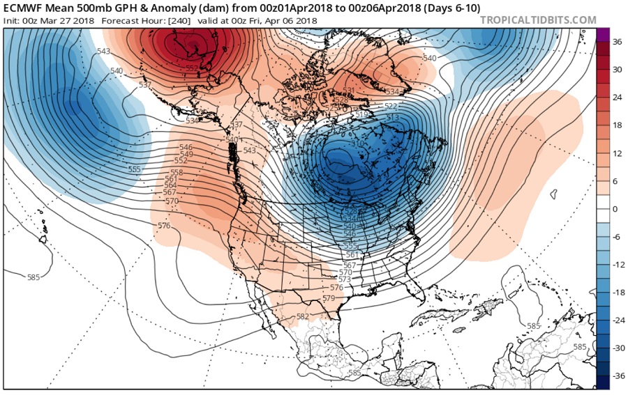
Computer-generated extended forecast guidance has been adamant that another piece of the polar vortex will become dislodged, sending an unusually cold air mass into the eastern United States during the first week of April. Had this been happening in January, frigid temperatures and wintry weather would have become a major problem for the Mid Atlantic and Northeast in such a scenario. However, with a higher sun angle and climatologically warmer conditions, a displaced piece of the polar vortex won’t nearly be as frigid in April. However, a significant cool-down from normal temperatures is expected as is the threat of snow.
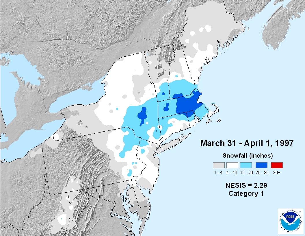
Snow in April isn’t completely unheard of in the northeast. As recent as 1997, the “April Fools Snowstorm” brought more than 20″ of snow to portions of the northeast on April 1. In 1982, a late-season snowstorm brought 10-20″ of snow in portions of New Jersey, Pennsylvania, and New York on April 6 and 7.
While it is too soon to know with certainty whether any snow will fall in the northeastern US in Early April with this unusual cold snap arriving, it is within the realm of possibilities. As such, people as far south as Pennsylvania and New Jersey shouldn’t put their snow shovels away quite just yet.
