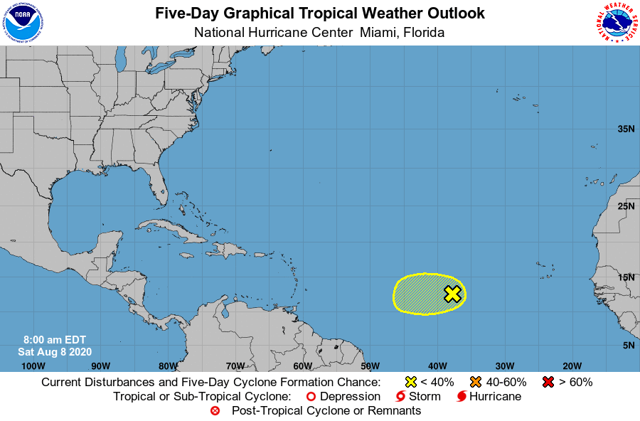
The National Hurricane Center in Miami, Florida is currently tracking a disturbance moving across the central Atlantic that has a chance of developing into a tropical cyclone next week. Additionally, a strong tropical wave has just emerged off of the African west coast; this too could develop into a tropical system over time.
While most global forecast computer models have suggested a brief pause to tropical cyclone activity in the Atlantic due to hostile atmospheric conditions, they’ve also suggested the pause wouldn’t last long. And just over the last few days, hurricane forecast experts have updated their seasonal outlooks to reflect a return to significant activity soon. On August 5, meteorologists with CSU’s Tropical Meteorology Project called for a significant uptick in tropical cyclone activity. On August 6, the nation’s lead hurricane forecaster at NOAA did the same, officially calling for the largest number of hurricanes and tropical storms they have ever made in any seasonal outlook.
For now, the National Hurricane Center says a tropical wave located several hundred miles west-southwest of the Cabo Verde Islands is producing a few showers and thunderstorms. Some slight development of this system is possible during the next day or so while it moves slowly westward. After that time, environmental conditions are expected to become less conducive for development. As such, odds of development are low for now.
However, meteorologists continue to monitor it and the disturbance that just came off the African coast; as conditions relax and become more favorable for tropical development beyond the next 5 days, new storms may be able to blossom in the basin.
The Atlantic hurricane season continues through November 30.