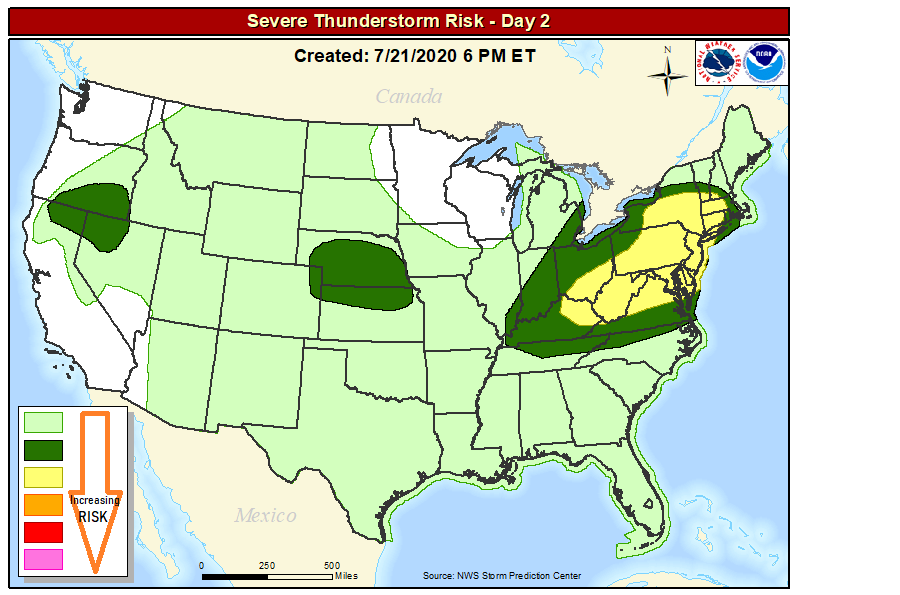
Another round of severe weather is expected to push through portions of the eastern United States Wednesday, with the greatest threat for severe weather action around New York, New Jersey, and Pennsylvania. In this region, severe thunderstorms with damaging wind gusts, large hail, and isolated tornadoes could be possible throughout the day and evening hours. Unlike previous weather events in this region, this won’t be an all-day, widespread soaking rain event; instead, isolated cells will grow in the morning, afternoon, and evening hours, impacting some locations but not all with thunderstorm activity.
According to the National Weather Service’s Storm Prediction Center, a shortwave trough will move quickly northeastward through the Upper Ohio Valley and Northeast on Wednesday. This shortwave is expected to dampen throughout the day as it enters the more confluent and stronger flow across the Northeast. Even so, the lingering periphery of the shortwave trough will help force thunderstorms as it interacts with the moist and unstable air mass in place from the middle Ohio and Tennessee Valleys into the Mid-Atlantic and Northeast.
The National Weather Service believes bowing line segments and clusters should be the dominant storm mode, with damaging wind gusts as the predominant severe threat. Deep-layer vertical shear decreases with southern extent, so the highest potential for more organized storms, and perhaps even a few supercells, exists from central Pennsylvania into Upstate New York and southern New England. In this area, the stronger vertical shear suggests slightly greater potential for hail and maybe even a tornado or two.
As the evening progresses. the threat of severe weather will quickly diminish.
