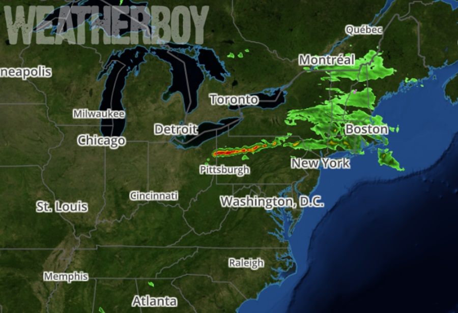
A line of severe storms has developed in portions of the northeast; as it sags south, the National Weather Service has issued a Severe Thunderstorm Watch for impacted areas. Within the Severe Thunderstorm Watch, Severe Thunderstorm Warnings have been issued too.
Severe thunderstorms blossomed this afternoon over portions of Ohio and Pennsylvania in a narrow corridor across the upper Ohio Valley into northwestern and north-central Pennsylvania. According to the National Weather Service’s Storm Prediction Center, damaging winds should be the main threat but severe hail and perhaps a couple of tornadoes are also possible as this activity spreads southeastward into this evening.
Earlier today, a weak warm front pushed through central Pennsylvania this afternoon and headed towards eastern Pennsylvania. Behind it, clear skies allow for abundant diurnal heating and gradual destabilization ahead of an advancing surface low and trailing cold front across the southern Great Lakes. Atmospheric dynamics are supporting a dominant linear storm mode in the form of a quasi-linear convective system or QLCS for short. The QLCS will provide the potential for strong, gusty winds and an isolated quick spin-up tornado embedded within the line as it pushes south; some small hail will be possible too, mostly with any storms that form ahead of the main line.
While there’s an enhanced risk of severe weather over much of central Pennsylvania, the Storm Prediction Center says there’s only a slight risk for severe weather across northeastern Pennsylvania and northwestern New Jersey. South of there, into the I-95 corridor, there is only a marginal risk. As storms head south and east tonight, they are expected to fizzle as they get into the more stable atmospheric set-up over central and southern New Jersey and points south.
The cold front will pass through the northern Mid Atlantic overnight and any lingering showers should dissipate shortly after midnight or so. Temperatures will drop into the 50s with some locations across the Delmarva only cooling to 60.
While showers should dissipate tonight, and any thunderstorms before that, there is some uncertainty regarding how quickly the responsible front will move through with a variety of guidance in disagreement on how far south the front will actually reach by Monday afternoon. According to the National Weather Service office in Mount Holly, New Jersey, consensus from guidance suggests the front will slow to a crawl by the time it reaches southern New Jersey and the Delmarva on Monday. Then, afternoon heating will allow for some isolated convection to form along the front as it continues to inch southward. Because of this, a chance for showers and an isolated thunderstorms for southern New Jersey and the southern Delmarva is in the cards for Monday afternoon.