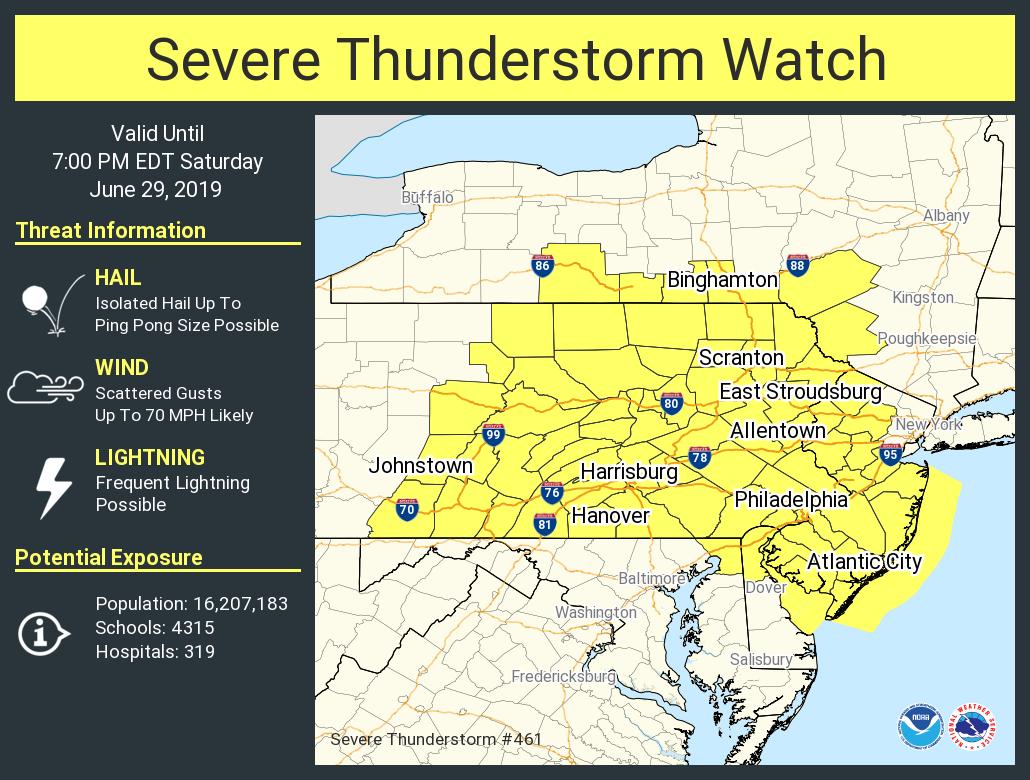
A severe weather outbreak is expected this afternoon in portions of the Mid Atlantic, prompting the National Weather Service to issue Severe Thunderstorm Watches for much of New Jersey, Pennsylvania, Delaware, Maryland, and portions of Virginia and New York. Washington, DC is also included in this watch area. Damaging wind gusts, large hail, and an isolated tornado are possible from severe storms as they blossom this afternoon into the early evening hours in this region.
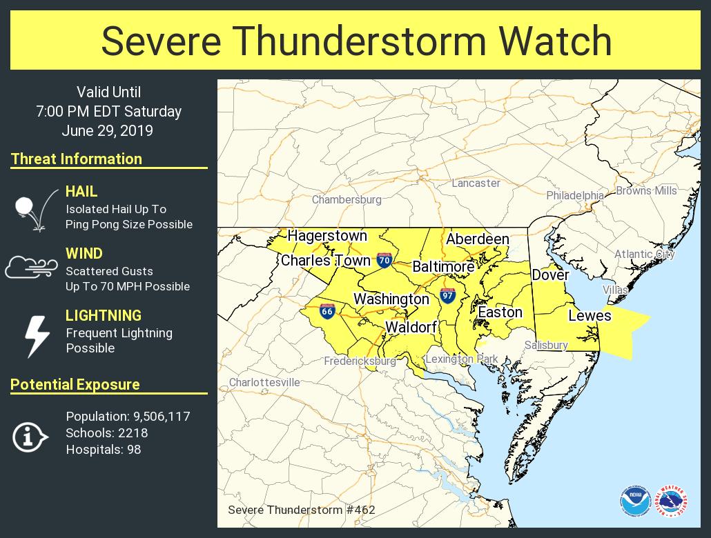
Multiple clusters of strong thunderstorms over south-central Pennsylvania will cross into portions of Maryland, Delaware, and New Jersey today while additional development occurs farther west. Scattered damaging winds are the primary threat from these storms. As such, a Severe Thunderstorm Watch is in effect for this region until 7pm tonight. A Severe Thunderstorm Watch means conditions are favorable for severe thunderstorms in and close to the watch area. Persons in these areas should be on the lookout for threatening weather conditions and listen for later statements and possible warnings. The National Weather Service cautions that severe thunderstorms can and occasionally do produce tornadoes.
The National Weather Service has issued two distinct watch boxes, one for portions of southern upstate New York, New Jersey, and Pennsylvania, while the other is further south and includes Delaware, Maryland, and portions of Virginia. Within these watches are Severe Thunderstorm Warnings where thunderstorms reaching severe criteria have formed. In order for a thunderstorm to be classified as severe, it must create at least one of the following: hail that is one inch in diameter or larger and/or winds of 58 miles per hour or greater. While thunderstorms may also contain heavy rain and frequent lightning, rain and lightning alone don’t make a storm severe.
The National Weather Service is reminding people of two catchy bad weather slogans. The first: “When thunder roars, head indoors. Lightning can kill!”, reminding people that if thunder is close enough to be heard, lightning is close enough to kill. The second: “Turn around, don’t drown!”; people should never drive through flood waters, especially flash floods created by strong or severe thunderstorms.
The severe weather threat in the Mid Atlantic region should diminish during the evening hours.
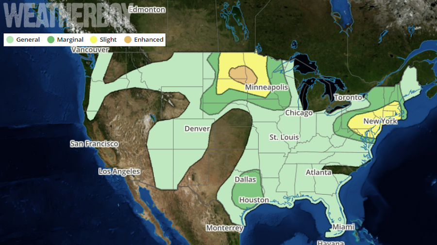
Severe weather is also impacting portions of the Upper Plains today. Renewed thunderstorm development is anticipated towards early evening in parts of central to eastern North Dakota as convergence along the residual outflow boundary/cold front overcomes weakness in the area. Once storms fire, they should rapidly intensify given the presence an extremely unstable air mass. As with the Mid Atlantic, severe thunderstorms and isolated tornadoes are possible here in portions of southern North Dakota, northeastern South Dakota, and western Minnesota.
