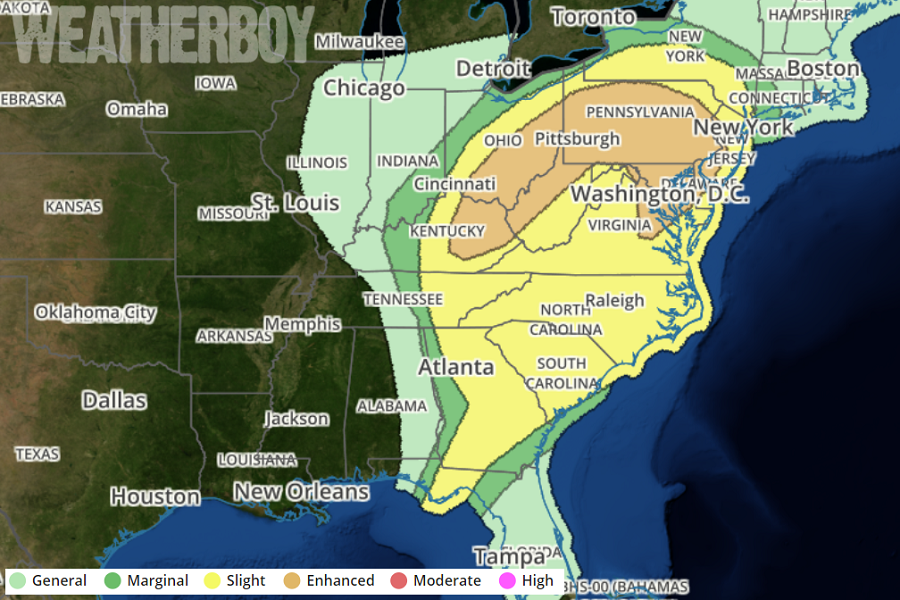
Severe weather is on the march north and east after bringing destructive hail and tornadoes to portions of the south yesterday. Severe thunderstorms are forecast today in parts of the Ohio Valley southward through the southern Appalachians and northeast Gulf Coast. Severe thunderstorms are possible this evening and tonight east of the Appalachians from the Carolina Piedmont northward into parts of the Mid-Atlantic states. The threat will come to a close across the northern Mid Atlantic by dawn tomorrow.
Scattered thunderstorms are expected to move from southwest to northeast across the outlook area through this evening, offering a primary threat of damaging to severe gusts, but with a few tornadoes also possible. By definition, a severe thunderstorm contains hail at least 1″ in diameter or greater and/or damaging winds in excess of 58 mph. While severe thunderstorms often contain lethal lightning or flash flooding, lightning and rain don’t help a thunderstorm reach the severe criteria, only the presence of high winds and/or large hail do.
Either Tornado or Severe Thunderstorm Watches could be issued for these areas in question. A Tornado Watch means conditions are favorable for tornadoes and severe thunderstorms in and close to the watch area. Persons in these areas should be on the lookout for threatening weather conditions and listen for later statements and possible warnings. Some warnings have already been issued for possible tornadoes spotted by observers on the ground or by National Weather Service weather RADAR. A Severe Thunderstorm Watch means conditions are favorable for severe thunderstorms in and close to the watch area. Persons in these areas should be on the lookout for threatening weather conditions and listen for later statements and possible warnings. Severe thunderstorms can and occasionally do produce tornadoes.
