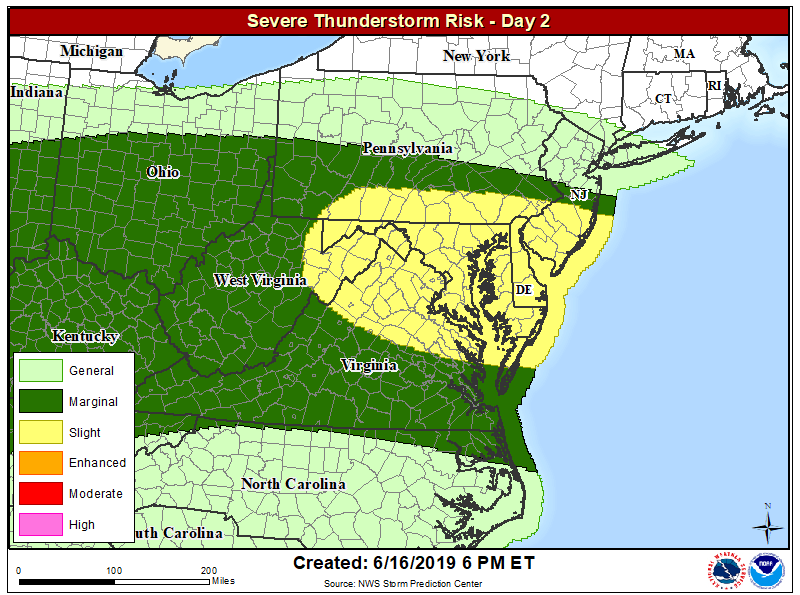
The weather pattern on Monday will be conducive to another severe weather event in a region of the country that has seen plenty in recent days and weeks: the Mid Atlantic. According to the latest Convective Outlook from the National Weather Service’s Storm Prediction Center, the greatest threat of severe weather will be over southern New Jersey, southeastern Pennsylvania, Maryland, Delaware, and northeastern Virginia.
A few tornadoes have touched-down in this region in recent days. On Thursday, two tornadoes touched down in southern New Jersey while a third hit in northeastern Maryland. Other storms produced damaging hail and wind gusts across a wider area of the Mid Atlantic.
A westerly mid-level flow will be in place across the eastern U.S. tomorrow as a subtle shortwave trough moves eastward into the Mid Atlantic. At the surface, a quasi-stationary front is forecast to stretch from northern Ohio into eastern Pennsylvania with a moist airmass south of the boundary. Model forecasts suggest that moderate instability will develop across much of Virginia and Maryland where surface dewpoints will be in the upper 60s to near 70. Thunderstorms that initiate along the front around midday should move east-southeastward into the stronger instability across the Mid-Atlantic during the afternoon. The meteorological ingredients coming together should be sufficient for isolated damaging wind gusts, with the greatest potential for wind damage along the leading edge of multicell line segments. While the primary threat will be from damaging winds, large hail and an isolated tornado cannot be ruled out.
People in the severe weather risk area should make sure they can receive/hear/read any severe weather alerts that may be issued by the National Weather Service. Severe Thunderstorm Watches or Warnings and Tornado Watches or Warnings may be issued. When a warning is issued, you may only have moments to get to a place of safe shelter.
