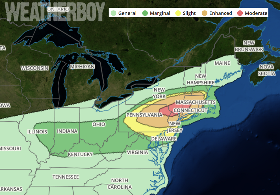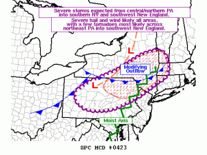
The likelihood that severe thunderstorms will blossom in the northeast is high today and the threat of strong, damaging winds from those storms is also high. Severe storms are likely to develop over the next several hours from central and northern Pennsylvania into southern New York, continuing into southern New England by late afternoon. According to the National Weather Service’s Storm Prediction Center, “severe wind and hail are likely across all areas, with a few tornadoes possible mainly from northeast Pennsylvania into southern New England.” Due to this threat, it is likely one or more severe thunderstorm and/or tornado watches will be issued today.

Many ingredients are coming together to produce today’s severe weather outbreak. The latest satellite imagery shows strong heating is occurring across the warm sector, with a plume of mid to upper 60s F dewpoints spreading north across Pennsylania and New Jersey, and likely into southern New York later today. Thunderstorms currently exist along a cold front from western Pennsylvania into western New York and should continue a gradual increase in intensity as the air mass destabilizes to the east. In addition to these storms, other storms are expected to form near the surface trough, and perhaps atop the old outflow boundary. Deep-layer shear will favor cellular activity away from the cold front, while a mixed storm mode including bows or embedded supercells are possible along the front. Strong heating and steep lapse rates aloft will favor large hail, with an increasing damaging wind by the time storms organize into a line. Any cellular activity will be capable of large hail, perhaps very large, along with a few tornadoes where low-level shear is maximized.
The National Weather Service is expected to issue severe weather watches soon. A Tornado Watch is issued when severe thunderstorms and tornadoes are possible in and near the watch area. It does not mean that they will occur. It only means they are possible. Severe thunderstorms storms that have winds of 58 mph or higher and/or hail 1″ in diameter or larger and/or a tornado. A Severe Thunderstorm Watch is issued when severe thunderstorms are expected within the area of the watch. A Severe Thunderstorm Warning is issued when a storm with severe criteria is observed while a Tornado Warning is issued when a tornado is identified on the ground by a trained observer and/or by weather RADAR.
While thunderstorms will continue to blossom throughout the day, the best chance for severe storms is during the late afternoon and early evening hours. The heaviest rain is expected between 4pm and 9pm; some heavy rain in thunderstorm cells could produce localized flash flooding during this window. The best chance for severe storms in the I-95 corridor are between 5pm and 8pm. While the thunderstorm activity should diminish as time continues after dark, the heavy rain from decaying storms could linger for many more hours, especially over southern Pennsylvania, southern New Jersey, Delaware, and eastern Maryland where a flash flood threat will persist into the night.