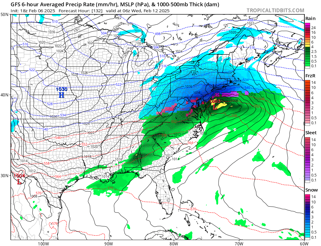
While an icy mess briefly moved through portions of the Mid Atlantic this morning before changing to plain rain , it appears enough cold air will be present for a storm next week to produce mainly snow. In fact, computer forecast model guidance is suggesting there will be a significant snowstorm along the I-95 corridor from Washington DC to New York City Tuesday into Wednesday, with the heaviest snow possible around Philadelphia, central and southern New Jersey, southeastern Pennsylvania, and northern Delaware.
Before then, this region will need to go through a near repeat performance of today’s storm this weekend where snow will fall in the northeast with freezing rain and sleet changing to plain rain across the northern Mid Atlantic and I-95 corridor. But that storm system, expected to move through late Saturday into Sunday , along with other atmospheric dynamics, will help steer the following storm system along a path more favorable for significant snowfall along the I-95 corridor.
The GFS and ECMWF are among many computer models meteorologists use to assist in weather forecasting. While meteorologists have many tools at their disposal to create weather forecasts, two primary global forecast models they do use are the ECMWF from Europe and the GFS from the United States. While the models share a lot of the same initial data, they differ with how they digest that data and compute possible outcomes. One is better than the other in some scenarios, while the opposite is true in others. No model is “right” all the time. Beyond the ECMWF and GFS models, there are numerous other models from other countries, other academic institutions, and private industry that are also considered when making a forecast.
Between the two global forecast models, the GFS is the most robust when it comes to forecast snowfall amounts over the Mid Atlantic. The ECMWF does show significant, plowable snow throughout much of the I-95 corridor, including Washington DC, but keeps the heaviest snow north and east of New York City.
The National Weather Service office responsible for the Philadelphia metro area is remaining uncommitted for now. ” While a lot can change between now and next week, models do continue to showcase an active long range period with the potential of multiple wintry events. The first being Tuesday into Wednesday,” they write in their latest Forecast Discussion. They also add there is another storm threat for Thursday and say, “As we move into next week, we`ll hone in on more precise timing and precipitation type.”
Until then, people in this region should monitor evolving forecasts and make pre-storm preparations this weekend if it still looks like a winter storm will materialize.
