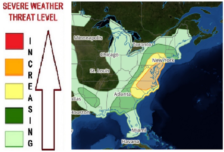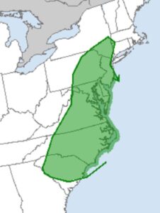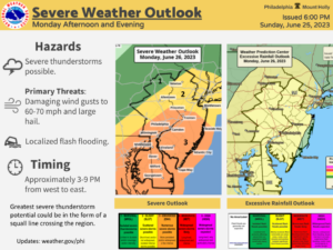
A significant severe weather outbreak is expected today in portions of the Mid Atlantic, with the greatest risk of severe weather expected in portions of New Jersey, southeastern Pennsylvania, Delaware, eastern Maryland and Virginia, and much of northern and eastern North Carolina. The severe weather threat also exists in the major metropolitan areas around Philadelphia, Washington DC, Baltimore, Richmond, and Raleigh-Durham. Isolated tornadoes, destructive winds, and damaging large hail are possible from thunderstorms expected to fire-up today. While not every one in this area will see severe thunderstorm, those that do could experience life and/or property-threatening conditions; as such, the National Weather Service and its Storm Prediction Center are urging people to be “weather aware” of changing conditions today.
According to the Storm Prediction Center (SPC), in a Convective Outlook issued earlier today, a variety of ingredients are coming together to create conditions ripe for severe weather in the Mid Atlantic. A relatively deep upper trough will remain over much of the eastern U.S. as an embedded deep-layer cyclone approaches the Upper Great Lakes region. An upper ridge will persist over the southern High Plains, while an upper trough remains over much of the West. A cold front will move across parts of the Ohio and Tennessee Valleys and into the Mid Atlantic and Northeast, helping trigger a severe weather outbreak there later today.
Multiple rounds of thunderstorms will be possible later today across parts of the Mid Atlantic and Northeast, within a favorably unstable environment in advance of the cold front. The strongest deep-layer flow associated with the upper trough will be displaced well to the south and west, but strong midlevel flow will support some modest effective shear across the region, especially where low-level flow remains somewhat backed. “A mix of storm clusters and perhaps a few marginal supercells are expected through the afternoon into the early evening,” the SPC warned, adding that damaging winds are expected to be the most likely hazard, though any sustained discrete cells may also pose a threat of hail and perhaps a tornado or two.

There is an elevated threat of tornadoes across southeastern New York away from New York City, all of New Jersey and Delaware, eastern Pennsylvania, most of Maryland, Virginia, and North and South Carolina.
However, the risks of tornadoes within this elevated risk zone are highest around the Carolinas. According to the SPC, somewhat stronger instability and deep-layer shear are expected across parts of the Carolinas later today, compared to areas farther north, though storm coverage may tend to decrease with southward extent. Atmospheric conditions over the Carolinas will support some initial supercell potential, with relatively steep midlevel lapse rates supporting a hail threat, including the potential for isolated very large hail. A tornado or two will also be possible with any sustained supercell, though there will be a tendency for upscale growth into one or more clusters, with an increasing threat for damaging gusts as storms move eastward toward the coast.
As of press time, no Severe Thunderstorm or Tornado Watches or Warnings were in effect, but that could change as the day ages.
A Severe Thunderstorm Watch means conditions are favorable for severe thunderstorms in and close to the watch area. Persons in these areas should be on the lookout for threatening weather conditions and listen for later statements and possible warnings. Severe thunderstorms can and occasionally do produce tornadoes. When a Severe Thunderstorm is identified by weather RADAR or tracked by a trained spotter, a Severe Thunderstorm Warning may be issued for a specific county. This means the dangerous cell is moving through or about to move through the warned county.
A Tornado Warning is issued when a tornado is observed by a trained spotter and/or indicated by weather RADAR. Should a Tornado Warning be issued for a specific area, the National Weather Service warns those there to take immediate cover by moving to a basement or to an interior room on the lowest floor of a sturdy building, all while avoiding windows. “If you are outdoors, in a mobile home, or in a vehicle, move to the closest substantial shelter and protect yourself from flying debris,” the National Weather Service cautions. In a Tornado Warning, people may only have seconds or minutes to act to save your life.
Thunderstorms may also produce excessive, heavy rainfall and create flood conditions. The National Weather Service has issued Flood Watches for this afternoon and evening for northern New Jersey, eastern Pennsylvania, and portions of south-central New York. Some thunderstorms will re-fire and move over areas hit earlier by storms, resulting in the same communities getting hit by multiple rounds of heavy rain. The National Weather Service is warning that 1-2″ of rain is possible, with localized amounts of 3-5″ possible.

Thunderstorms should dissipate after dark but they may fire up again during the afternoon heating of Tuesday. While severe weather is possible on Tuesday too, it is not expected to be as widespread as today’s forecast outbreak.
In between tonight and tomorrow, patchy dense fog may form too, especially over New Jersey, Pennsylvania, and Delaware. People should exercise caution if traveling through areas of dense, overnight fog.