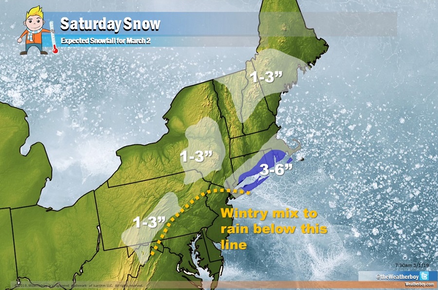
Another disturbance is forecast to bring another round of snow to portions of the northeast on Saturday. Most of the snow tied to this next system will fall over southeastern New England, where 3-6″ could fall over portions of southeastern Connecticut, southern Rhode Island, and even eastern Long Island.
Low pressure moving through the Mid Atlantic will produce rain in areas that saw snow today, such as Washington, DC, Philadelphia, and New York City. While there could be a wintry mix of sorts along and south of I-95 from Washington, DC to New York, a changeover to plain rain is expected.
While some light snow will add to totals in central Pennsylvania, most of the snow from Saturday’s system should focus on southeastern New England where the most precipitation will combine with the coldest air available in this set-up. Towards the end of the system, some light rain may also mix in with the snow in southeastern New England, capping snow totals there.
A more sizeable system is expected to impact this region late Sunday into late Monday.