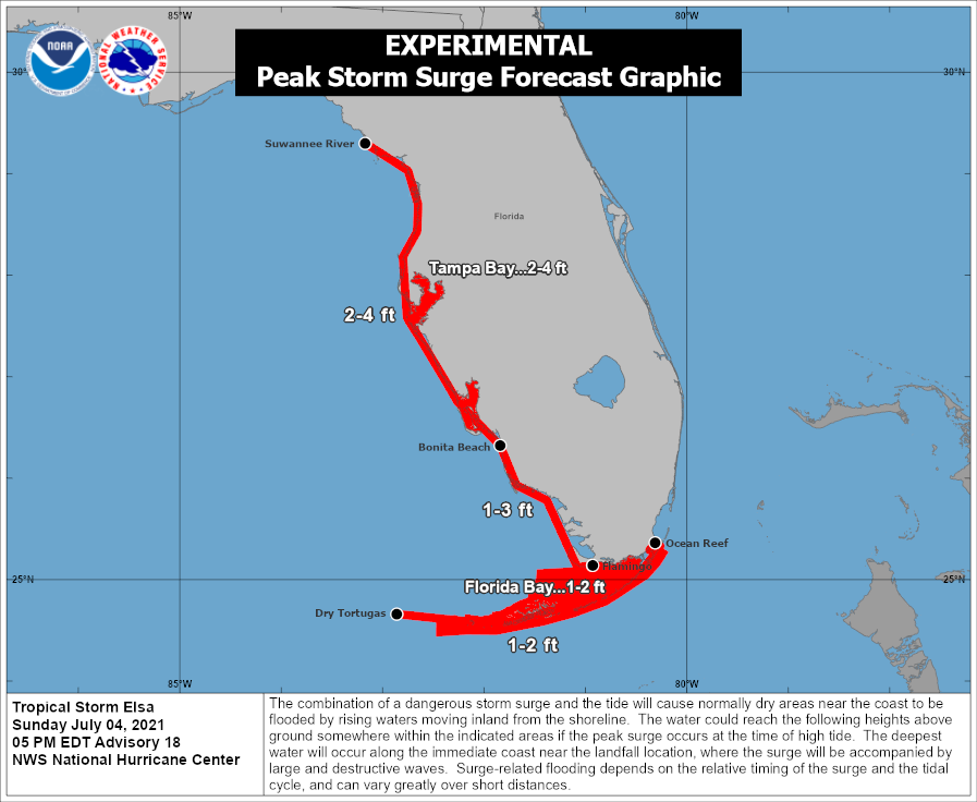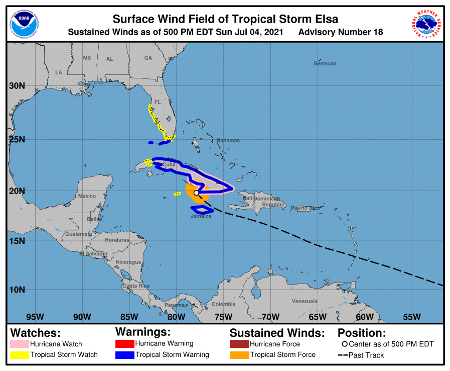
A storm surge from Tropical Storm Elsa is expected along Florida’s west and south coasts, prompting the National Hurricane Center to issue Storm Surge advisories for the Sunshine State.
The combination of a dangerous storm surge and the tide will cause normally dry areas near the coast to be flooded by rising waters moving inland from the shoreline. If the peak storm surge occurs at the time of high time, it could be 1-2′ across the Florida Keys from the Dry Tortugas to Ocean Reef including Florida Bay, 1-3′ from the Florida Keys north to Bonita Beach, 2-4′ from Bonita Beach through Sanibel and Captiva Islands, into the Tampa metro area, including Tampa Bay, and 2-4′ from Tampa Bay to the Suwannee River.

Because of the storm surge threat, a Storm Surge Watch is in effect for the west coast of Florida from Bonita Beach to the Suwannee River. A Storm Surge Watch means there is a possibility of life-threatening inundation, from rising water moving inland from the coastline, in the indicated locations during the next 48 hours.
“A dangerous storm surge is possible beginning as early as Monday night and continuing into Tuesday,” the National Hurricane Center warns. “There is a risk of tropical storm conditions, storm surge, and rainfall impacts along the remainder of the Florida Peninsula Tuesday night through Wednesday and the coasts of Georgia and the Carolinas Wednesday and Thursday.”