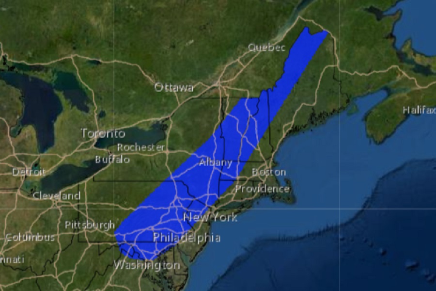
The National Weather Service’s Storm Prediction Center (SPC) is warning that tomorrow, Tuesday, could see an outbreak of severe thunderstorms with isolated tornadoes from Maryland to Maine. In their latest Convective Outlook, the SPC says there’s an elevated tornado risk across far northern Virginia, far northeastern West Virginia, most of central Maryland, much of the eastern half of Pennsylvania, northern and western New Jersey, southeastern Upstate New York, northwest Connecticut, western Massachusetts, most of New Hampshire and Vermont, and portions of western Maine. Beyond this area, there is also an increased risk of damaging wind gusts and large hail from these storms.
In their latest Convective Outlook, the SPC says that thunderstorms, accompanied by risk for damaging winds locally, are expected across parts of the Northeast and central Appalachians Tuesday. As a cold front advances eastward across the Northeast, pre-frontal heating of a rather moist boundary layer air will result in a very unstable airmass ripe for thunderstorm development. As the cold front advances, and disturbances aloft pass northeastward across the region within background cyclonic and southwesterly flow, ascent will support the development of showers and scattered thunderstorms within the destabilizing airmass, from midday/early afternoon onward.

The SPC adds, “Given moderately strong/roughly unidirectional southwesterly flow at low to mid levels, fast-moving storms should organize locally, with the stronger storms/clusters becoming capable of producing locally gusty winds and marginal hail. Risk should continue through sunset, spreading west-to-east with time, before eventually tapering off through late evening.”
On Tuesday, it is possible that the National Weather Service will issue Tornado or Severe Thunderstorm Watches for portions of the northeast for the afternoon and evening hours. Before any watches or warnings are issued, people there should remain weather aware and be ready to take action if severe weather strikes their area.
