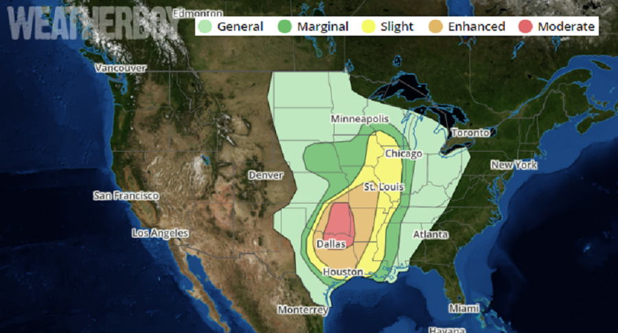
Another severe weather event is unfolding, with today, Tuesday, the apparent peak of this latest outbreak this week. The greatest threat of severe weather today will be over eastern Oklahoma, northeastern Texas, and western Arkansas, although strong to severe thunderstorms are possible from Wisconsin all the way south to the Gulf Coast.
Severe thunderstorms with widespread damaging winds, some greater than 75 mph, large hail, and a few tornadoes are expected to develop this afternoon and evening across parts of the Ozarks into the southern Plains. The metropolitan areas of Tulsa and Oklahoma City will be affected by these severe storms late this afternoon and this evening, and Dallas-Fort Worth overnight.
Meteorologists at the National Weather Service’s Storm Prediction Center describe the unfolding severe weather event. “Rich low-level moisture is spreading northward from Texas to Oklahoma and southeast Kansas, south of a cold front moving into southeastward across Kansas, and west of the morning convection from Texarkana southward along the Sabine River. This moistening is occurring beneath a plume of very steep midlevel lapse rates…” the latest Convective Outlook reads. “Convective inhibition will weaken along the front by mid afternoon, with rapid thunderstorm development expected near or just after 3pm from southern Kansas into Missouri.”
Before severe weather strikes, people in the risk area should review their plans of what they’d do in the event a Severe Thunderstorm or Tornado Warning were issued for their community.