After an active summer that brought numerous flood events and tornado outbreaks to the region, it appears that Pennsylvania and New Jersey are once again facing risks from tornadic thunderstorms and flooding rains on this first full day of autumn.
According to the National Weather Service’s Storm Prediction Center (SPC), isolated strong to severe storms associated with a marginal threat for a brief tornado and occasional wind damage is expected to continue today into tonight across parts of the Mid-Atlantic and southern New England. A band of showers and storms is moving across portions of the Mid-Atlantic now along and just ahead of a surface cold front. A zone of large-scale ascent associated with low-level warm advection and modest convergence along the front will continue through tonight, while making slow eastward progress as a closed upper low moves gradually northward across the Great Lakes region into southeastern Ontario. According to the SPC, the environment ahead of this activity should remain marginally favorable for isolated strong to severe storms. Visible satellite imagery shows a fair amount of cloud cover ahead of the line, which should slow diurnal heating and steepening of low-level lapse rates though the afternoon. However, a moist low-level airmass combined with modest diabatic heating should support some severe storm development, with greater instability across New Jersey and Delaware compared to southern New York and southern New England.
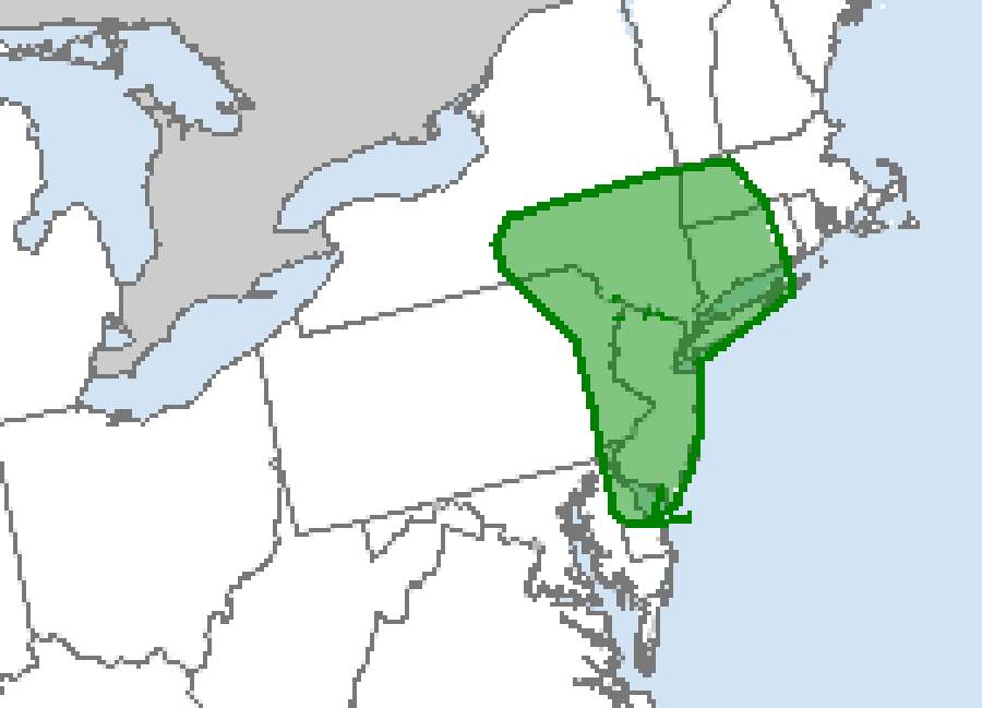
The SPC says a brief embedded circulation capable of producing a tornado or two remains possible in the northeast, with the greatest chances over eastern Pennsylvania, New Jersey, Long Island, southeastern New York including New York City, northern Delaware, western Massachusetts and most of Connecticut. Beyond the tornado threat, occasional strong to damaging winds should be the main threat through the rest of the day as the band of convection develops slowly eastward towards the Atlantic Coast. This marginal severe threat may continue through tonight across parts of southern New England, according to the SPC, where sufficient boundary-layer moisture can support weak instability and the potential surface-based storms.
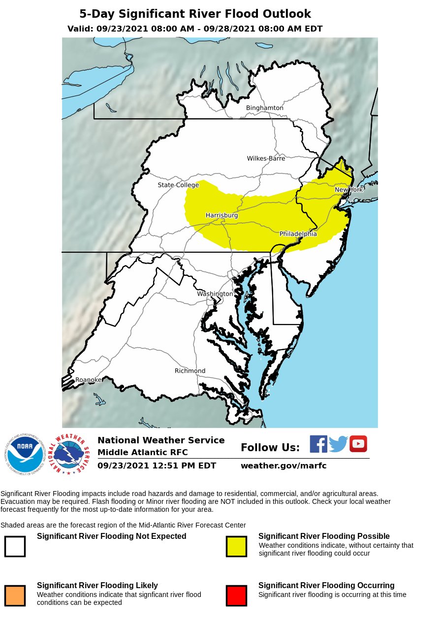
In addition to the threat of severe storms, showers and storms capable of producing very heavy rain are also expected in this same area. Rainfall greater than 2″ could fall over a short amount of time, creating isolated flash flooding conditions. In addition to flash floods, the Mid Atlantic River Forecast Center says there is the threat of significant river flooding across northern and central New Jersey as well as portions of southeastern Pennsylvania and northern Delaware; the area of concern includes the Philadelphia metro area. The National Weather Service warns: “Turn around, don’t drown; never drive through flood waters.”
As the front moves off the Mid Atlantic coast tonight, the threat of heavy rain will shift north and east into New England before drying out tomorrow.
