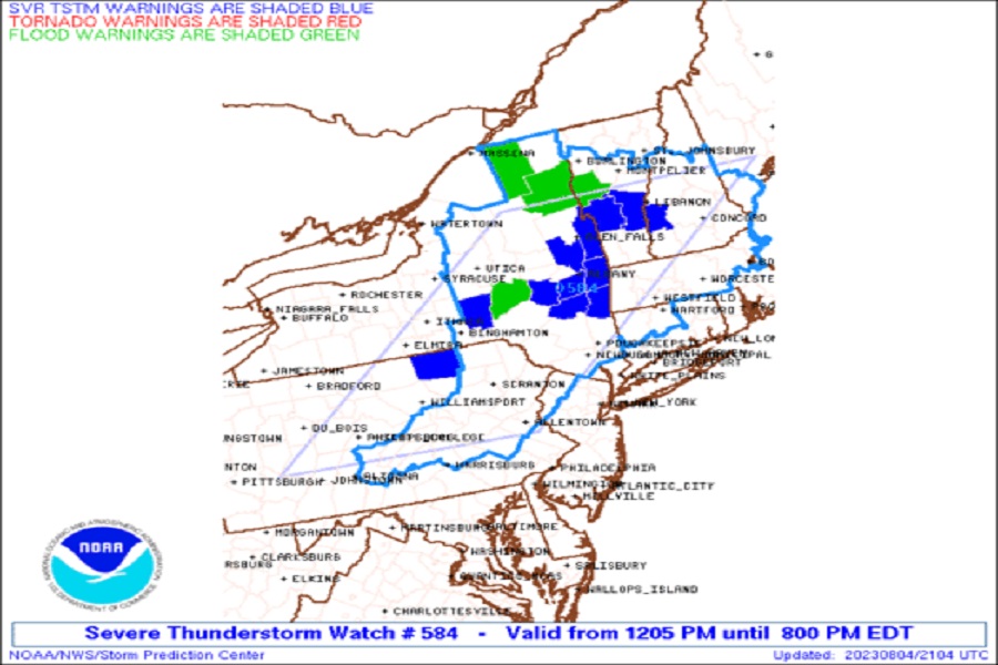
The National Weather Service issued Tornado Warnings earlier this afternoon for tornadic thunderstorms in both New York and Pennsylvania; a Severe Thunderstorm Watch remains in effect for a large part of the Northeast including central and northeastern Pennsylvania, northwestern New Jersey, eastern New York, much of Vermont, Massachussetts, and New Hampshire, and northwestern Connecticut.
According to the National Weather Service’s Storm Prediction Center (SPC), a broad mid-level trough continues to slowly progress across the Northeast as an upper ridge remains in place across the southern continental U.S., with multiple mid-level perturbations cresting the upper
ridge over the Central Plains. Across the Northeast, adequate clearing of clouds this morning helped efficiently heat the boundary layer beneath cooler mid-level temperatures and stronger flow aloft, promoting the ability for strong to severe thunderstorms to pop in the unstable environment.
“Multicells and transient supercell structures are expected, with large hail and damaging gusts the main concerns,” the SPC wrote in a Convective Outlook today.
In addition to the Severe Thunderstorm Watch which is up through 8 pm, there are also Flood Warnings being issued due to heavy downpours from the storms. The National Weather Service cautions people: “Turn around, don’t drown; never drive through flood waters.”
