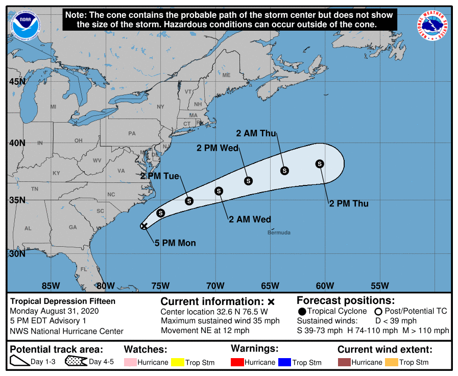
The National Hurricane Center in Miami, Florida, upon confirmation of data provided by Air Force Hurricane Hunter Reconnaissance aircraft, have classified a disturbance located off the U.S. East Coast as Tropical Depression #15. The system, located near latitude 32.6 North, longitude 76.5 West, is roughly 190 miles south-southwest of Cape Hatteras, North Carolina. It currently has maximum sustained winds of 35 mph. The estimated minimum central pressure if 1009 mb or 29.80 inches.
Right now, the newly formed tropical depression is moving to the northeast at about 12 mph. According to the National Hurricane Center, a general northeast or east-northeast track is likely for the next few days. While the storm heads north and east, it is forecast to intensify to tropical storm status by the National Hurricane Center; such intensification should happen tomorrow. Beyond tomorrow, the National Hurricane Center doesn’t expect additional intensification.
When Tropical Depression #15 is upgraded to tropical storm status tomorrow, as forecast, it would be given the name Nana. If this happens, Nana will break the record for the earliest “N” storm on record in the Atlantic hurricane basin. The current record earliest “N” storm is Nate, which formed on September 6, 2005.
Fortunately, even as a tropical storm, this system isn’t expected to bring any direct impasses to the United States; direct impacts to Bermuda and Canada are not expected either. However, indirect impacts in the form of rough surf are expected. Swells by the depressions are already impacting portions of the North Carolina coast, especially along the Outer Banks. These swells are likely to cause life-threatening surf and rip current conditions through tomorrow as they expand up the coast. Even experienced swimmers and surfers should avoid the ocean until the threat passes.
