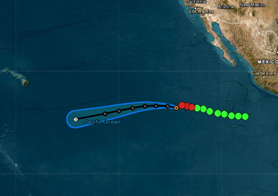
A new tropical depression isn’t forecast to do much as it marches west across the open waters of the eastern Pacific; in fact, the National Hurricane Center (NHC) in Miami, Florida expects the system to fizzle out well before it has the chance to bring any weather of consequence to the Hawaii Islands.
As of the latest advisory from the NHC, Tropical Depression #14-E is about 1,055 miles west-southwest of the southern tip of Baja California. With maximum sustained winds of 35 mph and a minimum central pressure of 1007 mb or 29.74″, the storm is moving to the west at 15 mph.
According to the NHC, a generally westward motion at a little faster forward speed is expected today followed by a turn toward the west-southwest on Monday. But as the system moves west, it’ll be doing so over colder water which will inhibit any growth. The environment should be hostile enough to turn the depression into a remnant low early this week.
The official NHC forecast has the remnant low dissipating well south and east of Hawaii’s Big Island later in the week.
