The first Tropical Depression of the Eastern Pacific Hurricane Season has formed. While the National Hurricane Center believes it could briefly become a tropical storm, it is forecast to eventually fade away in the coming days without making any direct impacts to land.
In the latest advisory from the National Hurricane Center (NHC), the overall convective pattern of the cyclone has changed little since the previous advisory. However, passive microwave images indicate that the low-level center has become less distinct and that the inner-core convection has become ragged. In addition, the coldest cloud tops have migrated from north through east to now south of the center during the past 12 hours, another indication that the inner-core of the depression is undergoing some structural changes. These changes indicate that the depression is not gaining strength in the short-term.
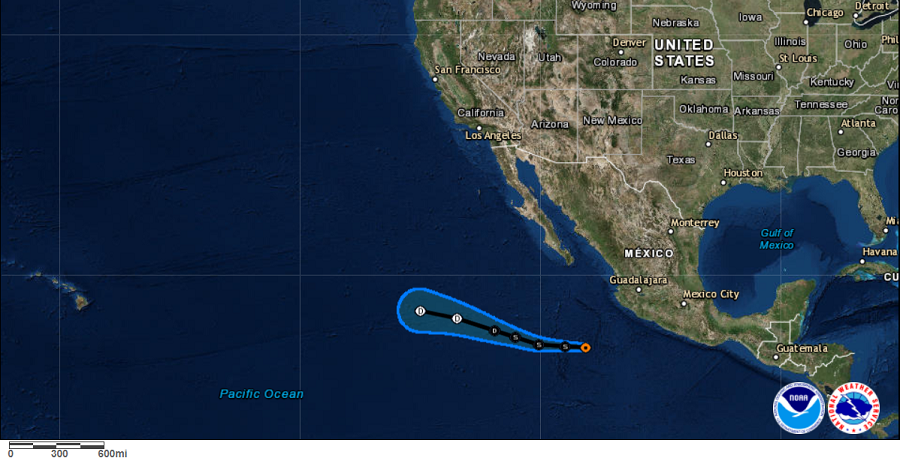
The latest track model guidance is in decent agreement on a westward to west-northwestward motion accompanied by a gradual decrease in forward speed over the next few days as a strong deep-layer subtropical ridge holds steady to the north of the cyclone. The new NHC track forecast is similar to but south of the previous advisory track, mainly due to the more southerly initial
position.
According to the NHC, there is a narrow window of opportunity for the system to strengthen into a tropical storm during the next 24 hours or so while the cyclone remains over warm water and in low vertical wind shear conditions. However, in about 2 days, the cyclone is expected to move over cooler ocean water and into a more stable environment that is not conducive for generating vigorous convection despite the favorable low-shear conditions forecast at that time. The combination of cooler waters, drier mid-level air, and increasing southwesterly wind shear shear are expected to induce steady weakening in about 2 or 3 days, with the NHC calling for dissipation in about 4 days.
Because the storm is expected to dissipate over time, it should not be a threat to its west in Hawaii nor should it be a threat to its east in Mexico.
