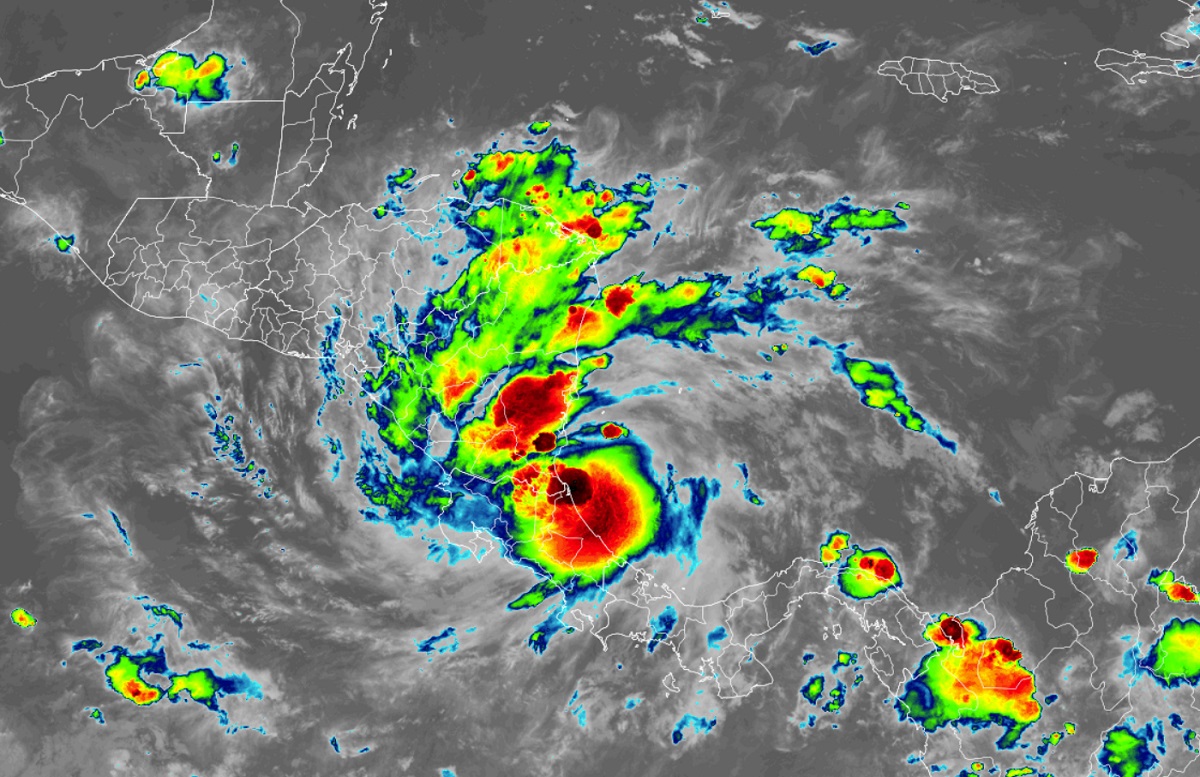
The system known simply as Potential Tropical Cyclone #2 was finally upgraded to Tropical Storm Bonnie; it is currently making landfall on the Atlantic coast of Central America. It will bring strong wind and heavy rain across Central America before emerging over the Pacific coast. From there, it is forecast to do something extraordinarily rare: remain as a tropical cyclone and intensify further to a hurricane.
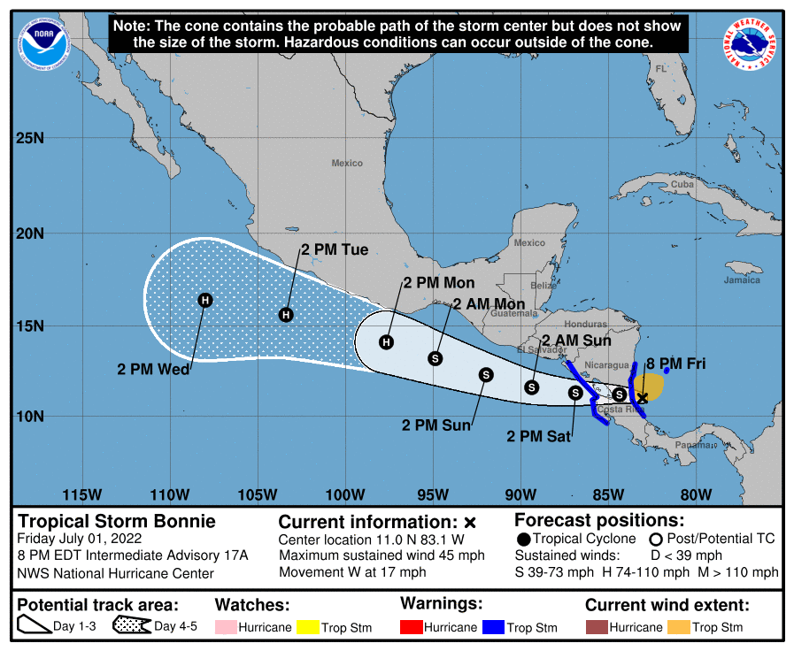
Tropical Storm Bonnie is moving toward the west near 16 mph, and a continued westward motion with a gradual decrease in forward speed is expected into Saturday night. A west-northwestward motion is expected to begin late Saturday night or on Sunday and continue into Monday. On the forecast track, the system will move across southern Nicaragua and northern Costa Rica tonight and emerge over the eastern Pacific Ocean on Saturday. The system will then move offshore of but parallel to the coasts of El Salvador, Guatemala, and southern Mexico Saturday through Monday.
Reports from an Air Force Reserve Hurricane Hunter aircraft indicate that before landfall maximum sustained winds increased to near 50 mph with higher gusts. Weakening is likely while the center of Bonnie crosses Nicaragua and Costa Rica. The storm is forecast to re-intensify over the eastern Pacific Saturday night and Sunday. The minimum central pressure estimated from the Hurricane Hunter
aircraft data is 997 mb or 29.44″).
Typically, mountains across Central America don’t allow a tropical cyclone from one hurricane basin to cross into the other. However, similar to Tropical Storm Alex’s roots earlier this season as a disturbance in the Pacific, this second storm of the unusual 2022 season will survive the journey to the Pacific from the Atlantic and remain Bonnie.
Since reliable records were kept in 1851, there have only been 18 cross-over tropical cyclones recorded. The last was November 2016’s Otto which traveled from the Atlantic as a Category 3 hurricane to the Pacific as a Tropical Storm.
In 2000, the World Meteorological Organization made a policy change to naming cross-over storms. Before that time, a system would get a new name when it entered the new basin. Otto became the first storm to retain its name and it appears Bonnie will be the second.
