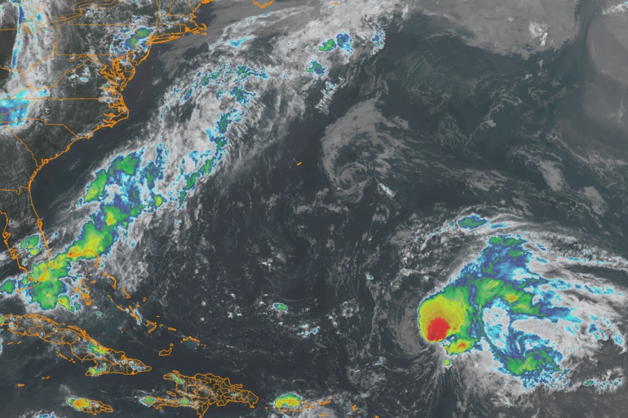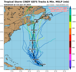
Tropical Storm Cindy is forecast to fall apart over the next 36-48 hours. According to the National Hurricane Center, strong wind shear passing over and through the storm is tearing it apart, disconnecting the circulation center of the system. However, Cindy may have a surprise ending for portions of Maine or Canada next week.

Meteorologist Philippe Papin with the National Hurricane Center wrote, “After Cindy dissipates as a tropical cyclone, there remains support from global and regional hurricane model guidance that Cindy could regenerate farther to the north in several days when the shear begins to abate. Enough uncertainty exists in the future thermodynamic environment to not explicitly show regeneration in the official forecast at this time, but this scenario will be continue to be monitored.”
For now, Cindy is a 45 mph Tropical Storm located about 435 miles north-northeast of the Lesser Antilles. It is moving to the northwest at 17 mph. Minimum central pressure is 1009 mb or 29.80″. Because it is out over open water, there are no coastal watches or warnings in effect at this time.
The National Hurricane Center expects Cindy’s forward speed to decrease over the next day or so with additional weakening expected over the next 24-36 hours. Cindy is expected to degenerate into a trough of low pressure by Monday night. While the possibility exists of regeneration beyond Monday, the National Hurricane Center has no further track forecast beyond Monday evening’s transformation into a trough.
Elsewhere in the Atlantic Hurricane Basin, there are no other areas of concern with regards to tropical cyclone development, nor does the National Hurricane Center expect any to pop up over the next 7 days.
The 2023 Atlantic Hurricane Season runs through to the end of November.