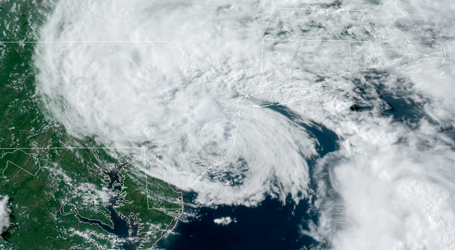
Tropical Storm Fay made landfall today near Long Beach Island, New Jersey. The center of circulation passed near Beach Haven and moved north and west towards Little Egg Harbor Township in the Garden State, packing maximum sustained winds of 50 mph as it did so. The last tropical storm to strike New Jersey was Tropical Storm Irene in August of 2011. While Sandy hit New Jersey in 2012, it did so as an extratropical cyclone. Irene and Sandy both hit New Jersey not far from where Fay did, within 10 miles of each other.
The National Hurricane Center expects Fay to weaken now that is over land in New Jersey. Tropical Storm Warnings that were in effect for southern New Jersey, Delaware Bay, and Delaware beaches are now no longer in effect; however, they remain in effect from Great Egg Inlet, New Jersey to Watch Hill, Rhode Island including Long Island and Long Island Sound. A Tropical Storm Warning means that tropical storm conditions are expected somewhere within the warning area.

For now, Fay is moving toward the north near 14 mph. The estimated central minimum pressure is 998 mb or 29.47″. Maximum sustained winds remain near 50 mph, but most of the tropical storm force winds with this system are mainly to the northeast and southeast of the center. JFK Airport in New York recently reported a wind gust to 45 mph while a weather station in Larchmont Harbor reported sustained winds of 35 mph.
The National Hurricane Center expects Fay to weaken as it moves north this evening. A northward to north- northeastward motion at a faster forward speed is expected tonight and Saturday. On the forecast track, the center of Fay will move over southeastern New York and western New England tonight and Saturday.
Rain will quickly wrap-up from south to north as this storm heads north. Rain is already done in Delaware and should be done at the Jersey Shore later this evening. Rain totals are around 2-4″ from this storm, with some isolated 6″ amounts possible along the storm track. This rain could result in flash flooding and urban flooding in areas with poor drainage where the heaviest amounts occur. According to the National Hurricane Center, rapid rises on small streams and isolated minor flooding is possible, but widespread river flooding is not expected.
With the storm moving over land, winds will decrease and all tropical storm force winds should weaken this evening. By tomorrow morning, what’s left of Fay should approach Quebec, Canada.
