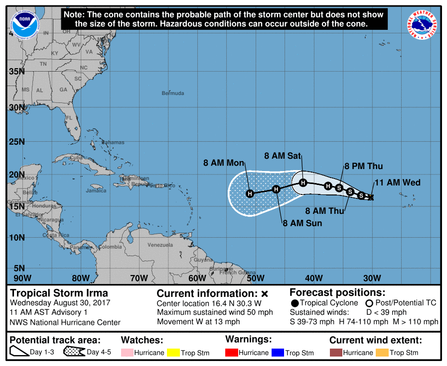
Tropical Storm Irma has formed over the open waters of the Atlantic and may pose a threat to the United States more than a week from now. The ninth named tropical cyclone of the 2017 Atlantic Hurricane Season, Tropical Storm Irma is currently located at 16.4N 30.3W and has maximum sustained winds of 50mph. The National Hurricane Center (NHC) expects the storm to gain strength and become a hurricane by the weekend. Some extended forecast guidance suggests Irma could become a Major Hurricane by the end of the weekend.
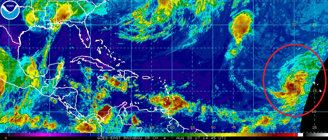
The NHC classified the system as a tropical storm this morning after evaluating the latest data. Satellite images indicate that the low pressure area in the far eastern Atlantic has become much better organized since yesterday, with many curved bands around the center. ASCAT data showed peak winds of about 42 kt, and after considering the small size of the circulation and some undersampling due to the resolution of the instrument, the initial wind speed is set to 45 kt by the NHC. Global models indicate that the upper-level winds are likely to be favorable for strengthening of Irma during the next several days. However, Irma will be moving over more marginal water temperatures and into drier mid-level conditions, which should temper the intensification rate. The NHC cautions that their current intensity forecast could turn out to be conservative if the very conducive environment shown in most of the global models emerges.
A ridge over the eastern Atlantic is forecast to steer Irma westward over the next few days. Thereafter, the ridge builds southwestward, which will likely cause the storm to move, somewhat unusually, toward the west-southwest. The official forecast from the NHC puts more weight on the global models than the regional hurricane models, which appear to have a northward bias in their latest forecast cycle. As a result, the NNHC track prediction is on the southwestern side of the guidance envelope, although not as far in that direction as suggested by the European ECMWF forecast model or its ensemble mean.
While the United States needs to monitor the future track of Irma, eyes remain on the Gulf States with Harvey and another potential Gulf storm.
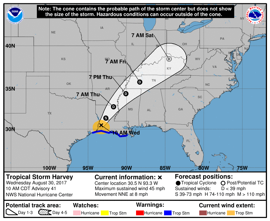
Harvey has changed little in organization since its most recent landfall, with satellite and radar data showing continued convective banding, most notably in the northwestern quadrant. Winds gusts of 35-45 kt have been reported over the coastal regions south of the center, and the
central pressure has risen only slightly to 993 mb. Radar and surface observations indicate that the center of Harvey moved northward for a period of several hours near landfall, but now is resuming a north-northeastward motion of roughly. The cyclone is located on the northwestern side of a mid-tropospheric high, which should steer it north-northeastward and then northeastward across the Lower Mississippi and Tennessee Valleys during the next few days until the system dissipates.
Harvey should gradually weaken as it moves farther inland, with the intensity expected to drop below tropical-storm strength shortly in about 12 hours from now. Subsequently, the system should decay to a remnant low in 3 days and dissipate completely in 4 days. The forecast weakening will not eliminate the risk of continued heavy rainfall and flooding along Harvey’s path, although the system’s faster motion will prevent rainfall totals from being anywhere near what occurred over southeastern Texas.
While Harvey is exiting the region, global forecast models, including the American GFS and European ECMWF, are suggesting that a new tropical disturbance will blossom in the southern Gulf of Mexico this weekend, bringing another round of flooding rain to the central Gulf region currently dealing with Harvey. There is no system there yet, but that could change in a week by now if those global models are accurate. This new potential system in the Gulf is not related to Irma.
The traditional peak of the Atlantic Hurricane Season is on/around September 10; as such, we expect more tropical activity to pop-up in the basin over the coming days and weeks. Residents along the entire US East and Gulf coast, as well as Hawaii, should make sure they have a Hurricane Action Plan in place.
Experts believe this Atlantic Hurricane Season, which runs through to the end of November, will be a busy one. Dr. Phil Klotzbach and the experts at Colorado State University updated their seasonal outlook again on July 5, showing a much more active than normal season expected. The National Oceanic and Atmospheric Administration (NOAA) also released their own forecast which shows this hurricane season to be likely more active than others.
