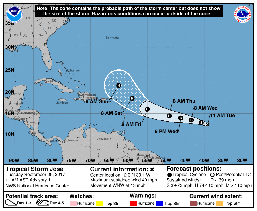
Hot on the heels of Major Hurricane Irma, Tropical Storm Jose has formed. The 10th named storm of the 2017 Atlantic Hurricane Season, Jose is expected to intensify to hurricane status by Thursday morning.
The National Hurricane Center (NHC) named the storm after observing intensification and organization this morning. Deep convection associated with the disturbance in the central Atlantic became more organized overnight. According to the NHC, banding features are starting to develop as seen in the first-light visible pictures from the GOES and METEOSAT satellite imagery.
With no history on the center location, the motion is estimated to be west-northwest at 11 kt. Jose should move toward the west or west-northwest for the next three to four days at a slightly faster rate of forward speed as it moves south of the deep-layer
Azores-Bermuda high. In about four to five days, Jose should turn toward the northwest and slow as it reaches the southwestern periphery of the high.
According to the NHC, the environment in which Jose is located in appears to be quite conducive for development for the next three days as the sea surface temperatures are very warm, the vertical shear is very low, and there is abundant mid-level moisture. By days four and five, however, the vertical shear may increase in part due to the outflow from Major Hurricane Irma to its west. Thus the official intensity forecast show steady intensification for three days and then remains flat for at least two days after that. The official size forecast suggests a gradual increase in size, based upon the computer tools the meteorologists at the National Hurricane Center use to determine such.
It is imperative that all US East Coast and Gulf Coast residents have a Hurricane Action Plan in place immediately. It may become necessary to act on it later this week ahead of Hurricane Irma’s arrival or soon after with Jose.
Experts believe this Atlantic Hurricane Season, which runs through to the end of November, will be a busy one. Dr. Phil Klotzbach and the experts at Colorado State University updated their seasonal outlook again on July 5, showing a much more active than normal season expected. The National Oceanic and Atmospheric Administration (NOAA) also released their own forecast which shows this hurricane season to be likely more active than others.
