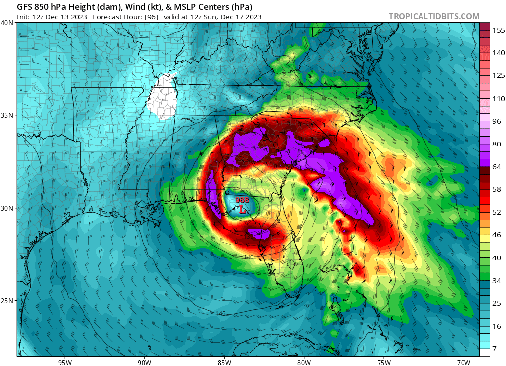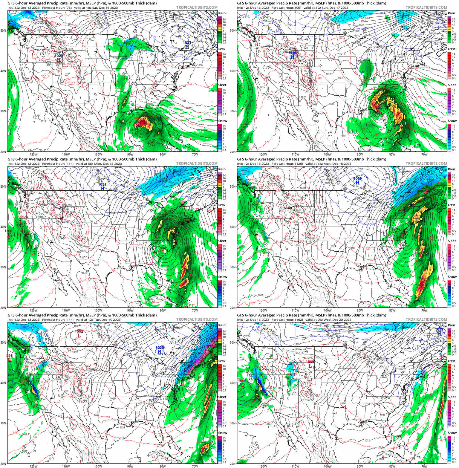
A tropical storm-like nor’easter will impact much of the U.S. East Coast this weekend, first striking Florida on its way up the coast before the center of circulation moves over New Jersey and the New York City metro area. The result will be wind-whipped heavy rains and the threat of fresh water and coastal flooding. Because of the mild air this storm will be contained within and bringing north up the coast with it, this will primarily be a rain-maker with little to no snow expected, even deep into New England.
The National Hurricane Center doesn’t believe it’ll take on tropical storm characteristics, but the storm system’s wind field could have tropical storm strength winds. In today’s Tropical Weather Discussion, the National Hurricane Center says, “A low pressure system is anticipated to form near the stationary front at the southeastern Gulf of Mexico on Saturday, then moves northeastward across central and northern Florida into the western Atlantic through Sunday. This system might cause southerly gales and very rough seas in the central and northeast Florida offshore waters on Sunday, and western Atlantic waters Sunday night through Monday.”
Ultimately, an interesting synoptic setup will exist in the southeast with a southern stream trough or cutoff low across the Gulf Coast or Southeast slowly drifting northeast toward the Mid-Atlantic. Meanwhile, a northern stream jet and trough will dive toward the upper Great Lakes region. This setup places the East Coast in a very broad and long duration period of upper diffluence, with a broad , strong area of surface low pressure likely to develop in response to this atmospheric set-up. According to the National Weather Service, this will likely start out as a broad and weak area of low pressure originating across the Gulf of Mexico developing later this week along a decaying stalled frontal boundary with plenty of convection associated with it.
The National Weather Service for Philadelphia, most of New Jersey, and Delaware warns, “we could quite possibly be looking at another widespread heavy rainfall event potentially accompanied by strong winds and coastal flooding concerns beginning Sunday night into Monday. Early indications are that rainfall totals could range anywhere from 1-3 inches, locally higher.” They also add, “The ground is now very saturated from last weekend’s storm, so a similar amount of rain just a week later will have much different outcomes and greater impacts from potential flooding.”
Beyond fresh water flooding, there is also the risk of weather hazards along the coast. The National Weather Service says, “There could also be high surf and beach erosion with this system. Details remain unclear, but anyone with hydrologic and/or coastal interests should monitor this system closely for potential impacts.”
For now, it looks like very strong winds and flooding rains will lash the entire state of Florida on Saturday. Expect significant travel delays and cancellations due to the severe weather. It looks like Fort Lauderdale may be hardest hit, with nearly a half foot of rain possible there and in an area stretching from West Palm Beach to Miami.
Florida will be the first to feel the impacts from this significant nor’easter later this week / weekend. Prepare for major weather impacts state-wide! #FLwx https://t.co/MhtuQlWKiy
— the Weatherboy (@theWeatherboy) December 13, 2023
From there, strong winds, heavy rain, and the risk of severe thunderstorms will march up along the southeastern U.S. coastal plain, with the worst of the storm to slide into Georgia and the Carolinas by Sunday.

By Monday morning, the center of the low pressure system will approach the Virginia / North Carolina border. Even before the storm center gets there, heavy rain will rush throughout all of New England.
On the back-side of the system in New England, when cold air will wrap around behind the departing storm system later Tuesday into late Wednesday, rain could change to snow, dumping several inches there, especially in far inland high terrain. While snow is possible in the Boston metro area, conditions should dry out in places like New York City and Philadelphia and points south before the colder air arrives, sparing those areas of any snowfall.