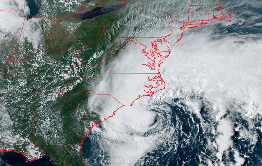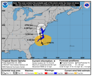
Tropical Storm Ophelia continues to gain strength off of the U.S. east coast; it is forecast to be just below hurricane strength when it makes landfall Saturday morning. Due to the threats of the arriving tropical cyclone, a variety of warnings and watches are in effect.
Right now, a Storm Surge Warning is in effect from Beaufort Inlet, North Carolina to Chincoteague, Virginia, for the area in Chesapeake Bay south of Colonial Beach, Virginia, theNeuse and Pamlico Rivers, and portions of Pamlico and Albemarle Sounds. A Storm Surge Warning means there is a danger of life-threatening inundation, from rising water moving inland from the coastline, during the next 36 hours in the indicated locations.
“This is a life-threatening situation,” the National Hurricane Center warns. “Persons located within these areas should take all necessary actions to protect life and property from rising water and the potential for other dangerous conditions. Promptly follow evacuation and other instructions from local officials.”

A Tropical Storm Warning is in effect for the area between Cape Fear, North Carolina and Fenwick Island, Delaware, the Albemarle and Pamlico Sounds, the Tidal Potomac south of Cobb Island, and for Chesapeake Bay south of North Beach. A Tropical Storm Warning means that tropical storm conditions are expected somewhere within the warning area
A Storm Surge Watch is in effect for the area extending from Surf City, North Carolina to Beaufort Inlet, North Carolina as well as the remainder of Pamlico and Albemarle Sounds. A Storm Surge Watch means there is a possibility of life-threatening inundation, from rising water moving inland from the coastline, in the indicated locations during the next 48 hours.
As of the latest advisory from the National Hurricane Center (NHC), Ophelia was located about 150 miles southeast of Cape Fear, North Carolina and about 185 miles south of Cape Hatteras, North Carolina. Ophelia is moving toward the north-northwest near 12 mph and the NHC expects this general motion to continue during the next day or so, followed by a slight turn toward the north. On the forecast track, the center of Ophelia will approach the coast of North Carolina tonight, and then move across eastern North Carolina, southeastern Virginia, and the Delmarva Peninsula Saturday and Sunday.
Data from the Air Force Reserve Hurricane Hunters and satellite wind data indicate that maximum sustained winds have increased to near 60 mph with higher gusts. Some slight strengthening is possible before landfall along the coast of North Carolina.
Tropical-storm-force winds extend outward up to 275 miles from the center. NOAA buoy 41025 at Diamond Shoals, North Carolina, recently reported a sustained wind of 47 mph and a gust of
60 mph. A NOAA C-MAN station at Cape Lookout, North Carolina, recently reported a sustained wind of 45 mph and a gust of 52 mph.
The estimated minimum central pressure is 992 mb (29.29 inches).
As the storm makes landfall, it will dump heavy, flooding rains, produce a significant, life-threatening storm surge, set-off several tornadoes, and produce wind damage.