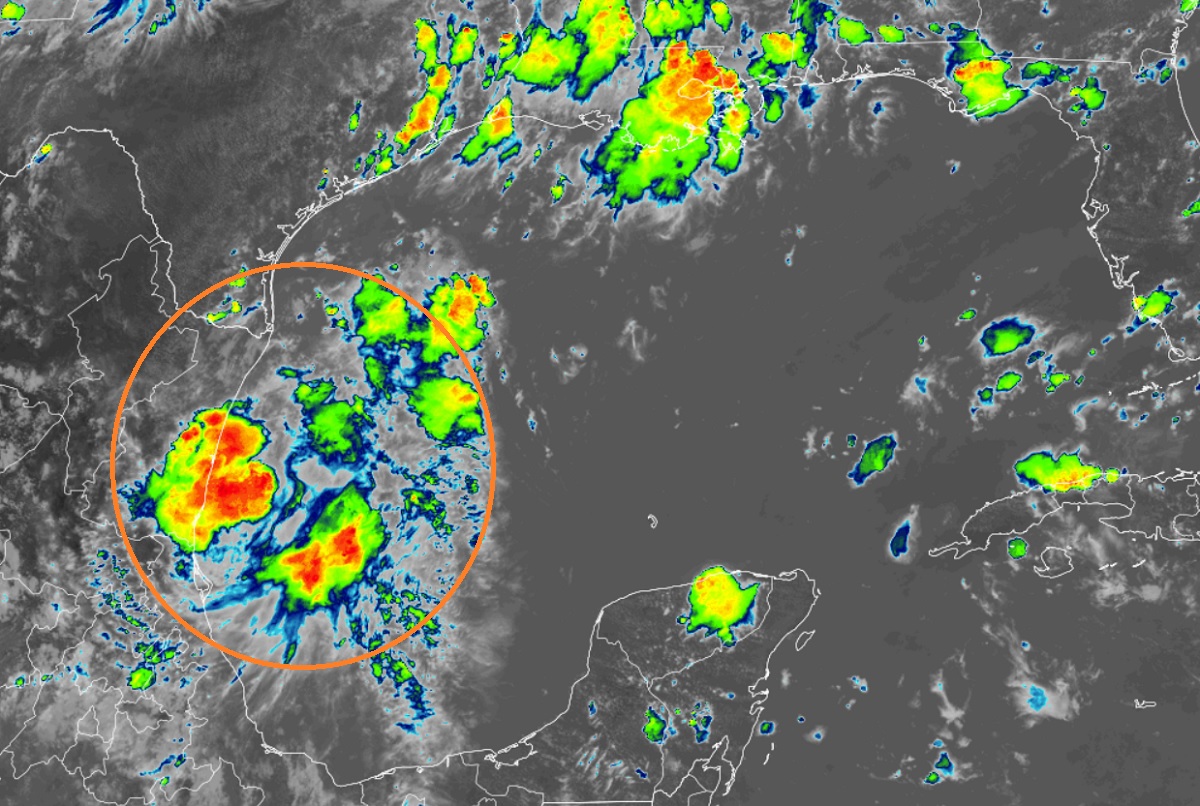
The National Hurricane Center (NHC) now believes there’s only a 40% chance that a disturbance in the Gulf of Mexico will become a better organized tropical cyclone. While it probably won’t become a tropical storm, tropical storm warnings are up for the southern Texas coastline with occasional tropical storm-like conditions likely there. What will also be likely in south Texas is heavy rain which could create flood problems.

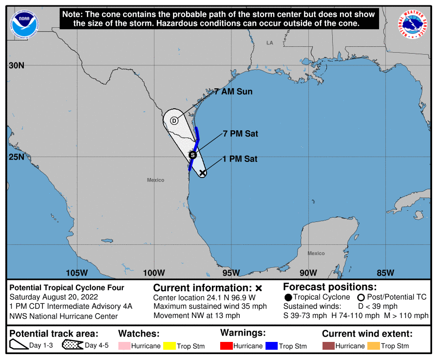
According to the last advisory from the NHC, the center of the disturbance was located about 105 miles south-southeast of the mouth of the Rio Grande River. For now, a Tropical Storm Warning is in effect for the Gulf coast of Mexico from Boca de Catan northward to the mouth of the Rio Grande and the lower Texas coast from Port Mansfield south to the mouth of the Rio Grande.
A Tropical Storm Warning means that tropical storm conditions are expected somewhere within the warning area, in this case within the next 12 to 24 hours.
Right now, the system is moving toward the northwest near 13 mph and the NHC expects this motion to continue this evening, with the system likely to move across northeastern Mexico and southern Texas this evening through early tomorrow morning.
Maximum sustained winds remain near 35 mph with higher gusts. The NHC says that the disturbance could still strengthen slightly and become a short-lived tropical storm before reaching the coast of northeastern Mexico, but the odds of that happening continue to fall.
Even if the system doesn’t become a full-fledged textbook definition of a tropical storm, it will produce tropical storm conditions from time to time and will result in a variety of weather hazards.

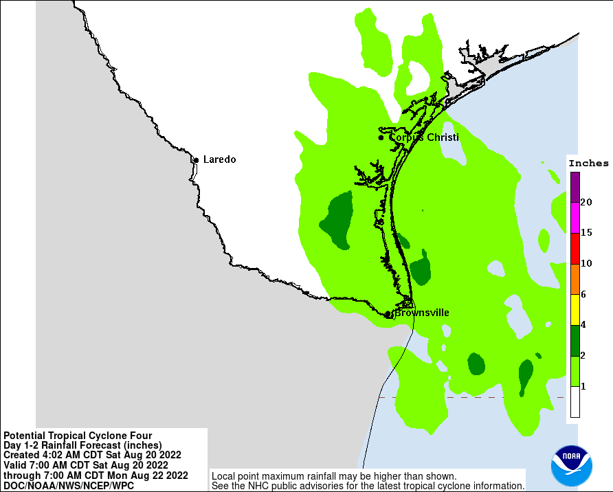
The disturbance is expected to produce total rainfall amounts of 1-3″ with isolated totals of 5″+, with the greatest amounts along the eastern coast of Mexico from the northern portions of the state of Veracruz across the state of Tamaulipas to Nuevo Leon through tonight. 1-3″ of rain will be possible in South Texas through Sunday morning. The potential exists for flash flooding elsewhere along the track of the disturbance.
The combination of storm surge and the tide will cause normally dry areas near the coast to be flooded by rising waters moving inland from the shoreline. Because the system isn’t expected to become a significant tropical cyclone, storm surge will be minimal; however, the water could reach up to 1′ if the peak surge occurs at the time of high tide from the mouth of the Rio Grande to Port Mansfield, Texas. Surge-related flooding depends on the relative timing of the surge and the tidal cycle, and can vary greatly over short distances.
Rough surf and swells generated by this system are forecast to affect eastern Mexico and southern Texas through early Sunday. According to the NHC, these swells are likely to cause life-threatening surf and rip current conditions.