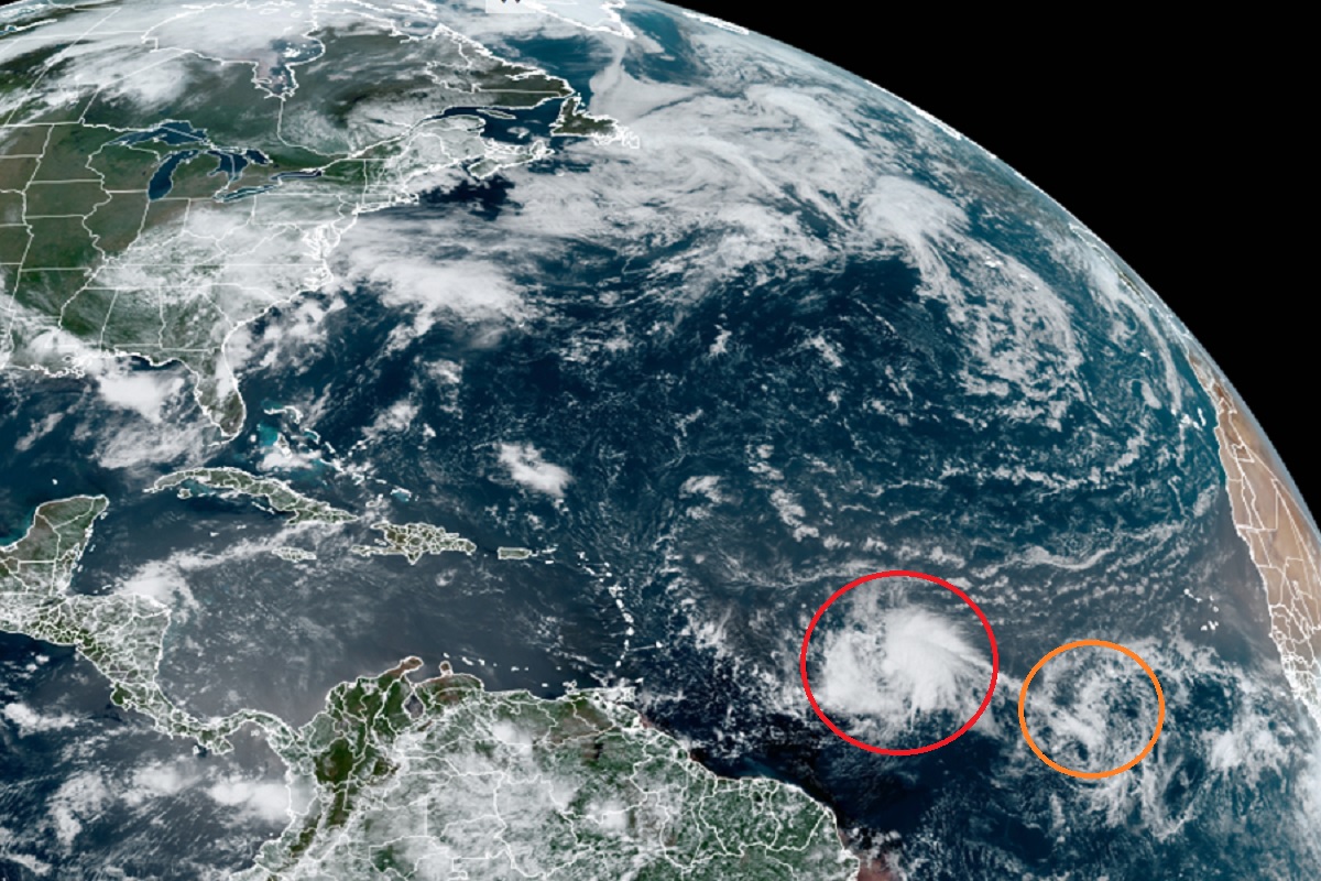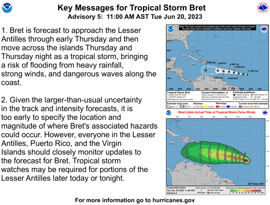
The National Hurricane Center (NHC) says that Tropical Storm or Hurricane Watches may be issued later today well before Bret’s expected arrival into the Caribbean as either a tropical storm or hurricane. While Bret is marching west, another disturbance is being monitored by the NHC for development; that system has a chance of eventually becoming Tropical Storm Cindy. Everyone in the Caribbean is urged to be on alert for both of these systems and their possible impacts over the next several days.
As of the latest advisory from the NHC, the center of Tropical Storm Bret was located near latitude 11.9 North, longitude 47.0 West, is moving toward the west near 21 mph, and has maximum sustained winds of 40 mph. Bret’s estimated minimum central pressure is 1008 mb or 29.77″. According to the NHC, this general westward motion is expected to continue for the next several days. On the forecast track, the center of Bret could move across portions of the Lesser Antilles Thursday afternoon through Thursday night. Some strengthening is forecast during the next couple of days, and Bret is expected to be a tropical storm when it reaches the Lesser Antilles Thursday and Thursday night. It’s possible Bret could intensify into a hurricane, but for now, the NHC is calling for a tropical storm strength system to impact the islands for now.

As Bret approaches the island, heavy rain is possible. Rainfall amounts of 4-6″ with maximum amounts of 10″ are possible across portions of the Lesser Antilles from Guadeloupe southward to St. Lucia. Rainfall amounts of 2-4″ are possible across Barbados and St. Vincent and the Grenadines. The heavy rainfall could lead to flash flooding, especially across areas of higher terrain. Isolated urban flooding is also possible.
While busy forecasting Tropical Storm Bret, the National Hurricane Center is also tracking a disturbance to its east that is moving west too. Shower and thunderstorm activity has diminished during the past several hours in association with a tropical wave located several hundred miles southwest of the Cabo Verde Islands. However, environmental conditions appear conducive for further development of this system, and the NHC says a tropical depression will likely form during the next couple of days while the system moves westward at 10 to 15 mph across the eastern and central tropical Atlantic. The NHC is confident that a tropical cyclone will form here; they peg odds of formation at 70% over the next 48 hours and raise them to 80% for the period over the next 7 days.
The 2023 Atlantic Hurricane Season officially began on June 1 and continues through to November 30.