While Tropical Storm Odette is spinning about well east of the Jersey Shore and the U.S. Northeast, the National Hurricane Center (NHC) is monitoring two other disturbances that could become tropical cyclones in the coming days.
Fortunately for the northeastern U.S. and eastern Canada, Odette is moving more east than north. Such a path will spare the entire North American coastline from direct impacts from the storm. However, dangerous rip currents will continue for a few more days as rough surf from Odette impacts the coastline even as it moves away.
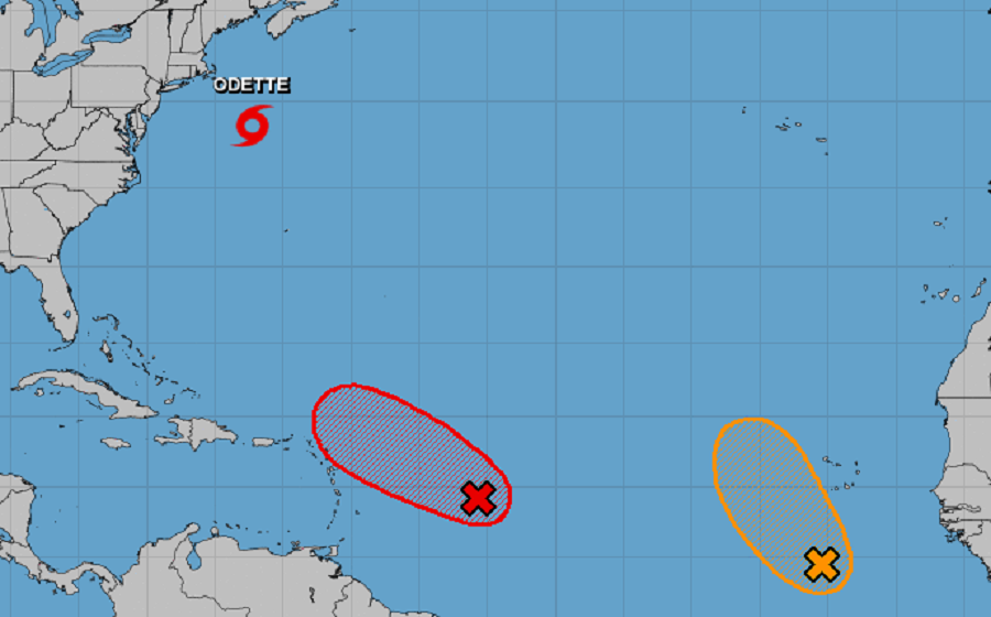
While Odette moves away from land, the National Hurricane Center is tracking two other systems; both are likely to become tropical cyclones in the coming days, but it isn’t clear if either will impact land.
The first system is located roughly 650 miles east-southeast of the northern Leeward Islands. With showers and thunderstorms bubbling up today from the system, the National Hurricane Center (NHC) says it is showing some signs of organization. However, satellite-derived wind data from a few hours ago indicated that the system does not yet have a well-defined surface circulation. Nevertheless, only a slight increase in organization of this system would lead to the formation of a tropical depression or tropical storm, which is expected to occur later today or tonight while the low moves toward the west-northwest at about 15 mph. If and when it becomes a named storm, it would be called Peter.
This system is expected to be near the northern Leeward Islands on Monday and Tuesday, and interests there should monitor its progress. According to the NHC, upper-level winds are likely to become less conducive for development when the system reaches the southwestern Atlantic by the early to middle part of next week.
The second system is in the far Atlantic just beyond the coast of Africa. According to the NHC, a low pressure system located over the far eastern Atlantic a few hundred miles south-southwest of the Cabo Verde Islands continues to show some signs of organization. Environmental conditions appear conducive for further development of this system, and a tropical depression could form over the next couple of days while moving toward the northwest at 10 to 15 mph to the west of the Cabo Verde Islands. If this system were to be named after Peter, it would be named Rose.
