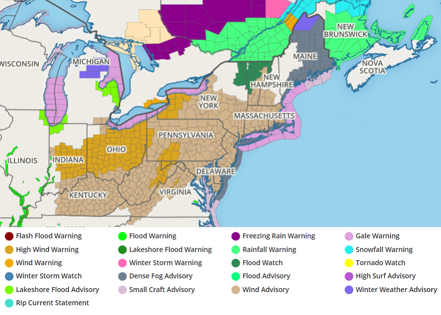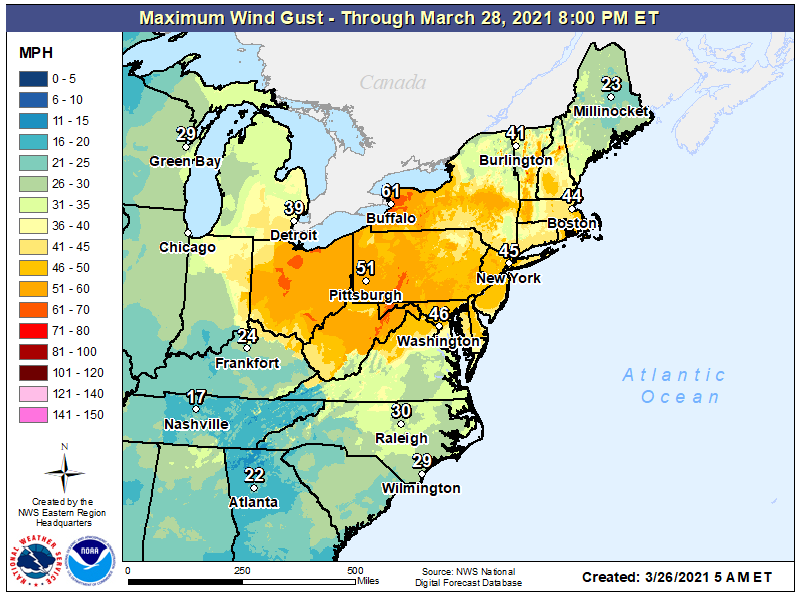
A windstorm is expected to impact portions of the northeast today, with some of the most fierce winds expected over portions of New York, Pennsylvania, Ohio, and Indiana. Because of the risk of damage from the winds, the National Weather Service has raised High Wind Warnings and Wind Advisories for portions of Indiana, Ohio, Kentucky, Virginia, West Virginia, Maryland, Delaware, New Jersey, Pennsylvania, New York, Massachusetts, Vermont, New Hampshire, Connecticut, and Rhode Island.
A series of fronts swinging through the Great Lakes, Mid Atlantic, and Northeast are responsible for today’s gusty winds. This morning, two embedded shortwave troughs, one in the central Plains and the other in the Rockies, surround a large-scale trough in western/central North America. An intense jet streak is racing north into Ohio and Tennessee Valleys east of a potent
vorticity maximum in the lower Missouri Valley. A strong southerly low-level flow was aiding in considerable warm and moist advection from the Gulf Coast to the Great Lakes, with a closed low in Missouri and Illinois. The aforementioned vorticity maximum is expected to reach the eastern Great Lakes this morning, with the attendant surface low following the U.S./Canada border during the day.

In this atmospheric set-up, a double-frontal structure exists with this system, with the first front moving through this morning into the early afternoon. After this first front passes, much stronger southwest winds should develop across the northeast.
With strong mixing and improving sky conditions later this morning into this afternoon, very warm temperatures for this time of year are expected this afternoon. In places like Philadelphia, the record high for the day of 80 is expected to be tied or broken; other records are possible in portions of the Northeast and Mid Atlantic.
Unfortunately, the strong winds forecast to move through could also create problems. In the Wind Advisory area, winds of 20-30 mph with gusts over 50 mph are possible. In the High Wind Warning area, winds of 35-35 mph are expected with gusts to or over 60 mph possible. Damaging winds will blow down trees and power lines; travel will be difficult, especially in high profile vehicles. Power outages are possible as the strongest gusts move through.
The strongest winds will reach locations west of central Pennsylvania and New York by lunchtime; the worst will arrive in the I-95 corridor from Washington, DC to Boston after lunch to dinner time.
The National Weather Service wants people to stay safe. “People should avoid being outside in forested areas and around trees and branches,” they warn. “If possible, remain in the lower levels of your home during the windstorm and avoid windows. Use caution if you must drive.”