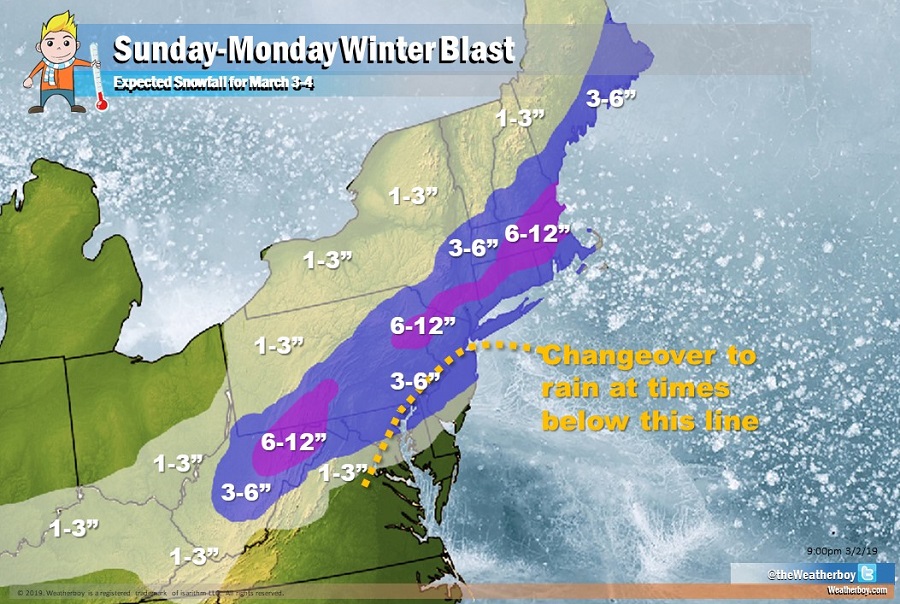
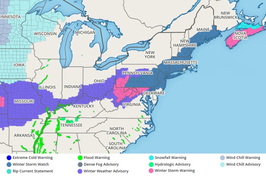
Another in a series of winter storms will blast through the northeast, bringing another round of snow and rain to an area that has seen an abundance of precipitation this winter. Unlike past storms, this could drop more snow, especially near the I-95 corridor. More than a half foot of snow is possible for the Boston area which would be the largest snowfall this year for an area that hasn’t seen much snow. With snow coming, the National Weather Service has issued Winter Storm Watches for a large area.
Precipitation associated with this system will move into the Mid Atlantic from southwest to northeast on Sunday afternoon. Temperatures will be warm enough for rain across the DelMarVa area and south, with a rain/snow mix as far north as the Lehigh Valley of Pennsylvania and northern New Jersey. Precipitation is forecast to intensify Sunday evening as the low redevelops east of the Delaware coast. As it does, colder air will filter around the low, helping temperatures to drop below freezing. This will change precipitation to snow for a large part of the region, with the exceptions Cape May County, NJ and south into central and eastern Virginia. On Monday, the snow on the south side of this system may turn back to rain briefly.
The heaviest precipitation from this storm should fall between 7:30pm Sunday evening through to 2:30am Monday morning.
The rain/snow line is very close to the I-95 corridor near Philadelphia and New York City. Should the storm shift just a few miles south, significant snow could spread south. It’s also possible the storm could shift a few miles north, bringing the rain/snow line above these cities. Because of uncertainty tied to the rain/snow line, the National Weather Service has issued a Winter Storm Watch pretty far south; this will be trimmed back to Warnings or Advisories once the rain/snow line establishes itself.
Precipitation will wrap up from southwest to northeast on Monday morning. Dry, fair high pressure will return during the afternoon Monday, with colder than usual temperatures arriving along with brisk northwest winds.
