The National Weather Service office on the island of Oahu at Honolulu has issued a Winter Storm Warning for portions of the Big Island due to the expectation of heavy snowfall there. According to the National Weather Service, 10″ of snow is possible through tomorrow morning at the higher elevations of Hawaii Island; that heavy snow will be joined by winds gusting up to or over 60 mph, which could create blizzard conditions at times.
A surface Kona low pressure system continues to meander northeastward away from the Hawaiian Islands, producing bands of moderate to heavy showers and embedded isolated thunderstorms across much of the state, namely Maui County and the Big Island. In addition to flooding rains throughout much of the islands, this disturbance is also creating heavy snow at the colder summits on the Big Island of Hawaii.
The Kona Low gets its name from the change in wind direction that occurs when such a storm moves over the Hawaii Islands. Hawaii is dominated by the trade winds that typically blow in from the northeast. However, the counter-clockwise flow around a Kona low located west of Hawaii results in southwesterly winds over the islands, which is typically the leeward or “Kona” side. Kona Lows are most common between October and April. These type of storms draw abundant moisture up from the warm tropical waters that surround Hawaii; when this moist flow interacts with the steep topography of the island which helps to wring-out moisture, extremely heavy precipitation can fall. Because the wind flow around a Kona Low is atypical, flooding rains occur in places that may not ordinarily flood in tropical downpours that impact the islands from time to time.
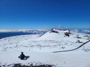
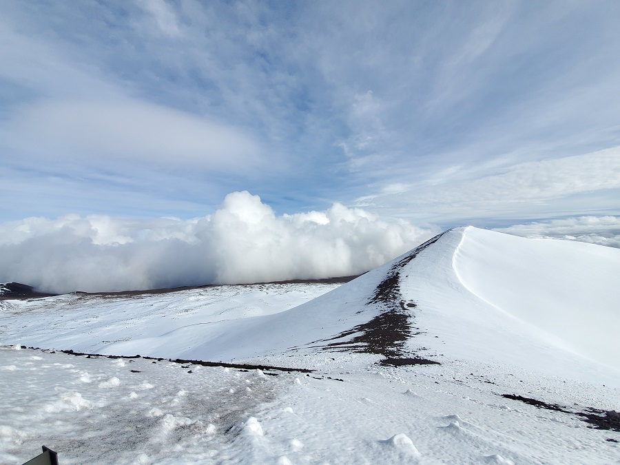
While heavy rain floods lower elevations, the higher terrain of the Big Island will see very heavy snow. While most people don’t associate the tropical paradise Hawaii is known for with snow, they’re surprised to learn that it does snow in the winter due to the elevation of its volcanic peaks. Mauna Kea is the highest of the bunch at 13,803 feet. Maui’s Haleakala is much lower at 10,023 feet. Because of that difference, Hawaii Island will see snow more frequently than the lower peak of Maui Island. Just one storm in January 2020 dropped 2-3 feet of snow on Hawaii Island and created snow drifts that were far deeper. Another storm in 2021 brought snowboarders and skiers out to the mountain by the dozens.
“Travel could be very difficult to impossible. Blowing snow will significantly reduce visibility at times, with periods
of zero visibility,” warns the National Weather Service about the Winter Storm Warning on Hawaii Island. “A Winter Storm Warning means significant amounts of snow, sleet, and ice are expected or occurring. Strong winds are also possible. This will make travel very hazardous or impossible. Any travel plans to the summits should be postponed until the threat diminishes,” they add.
As the system exits the vicinity of the islands, a broad area of high pressure will fill in its wake Monday, allowing trades to return
from west to east, persisting through the remainder of the week. While windward showers will initially be scattered to numerous Monday, they will decrease to a more typical trade wind regime with isolated to scattered showers across windward and mauka areas for the balance of the week, allowing those in the Aloha State to recover from two back-to-back Kona Low storms that not only brought heavy snow to Hawaii, but catastrophic flooding and damage state-wide.
