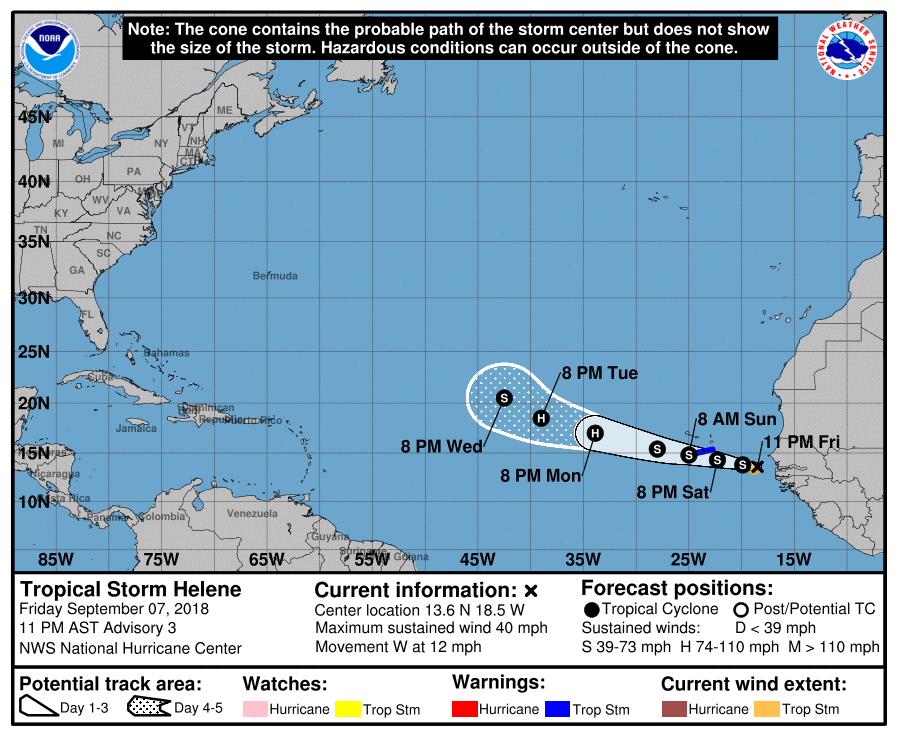
Joining Tropical Depression #9 and Tropical Storm Florence in the Atlantic hurricane basin is newly minted Tropical Storm Helene. As part of the 11pm update from the National Hurricane Center (NHC), Tropical Depression #8 was upgraded to the 8th named storm of the 2018 Atlantic Hurricane Season.
At this time, a Tropical Storm Warning is in effect for Santiago, Fogo, and Brava. A Tropical Storm Warning means that tropical storm conditions are expected somewhere within the warning area within 36 hours.
Helene has formed in the far eastern Atlantic. The center of the tropical storm is a little to the east of previously indicated position, and at 1100 PM AST was located near latitude 13.6 North, longitude 18.5 West. Helene is moving toward the west near 12 mph (19 km/h), and a westward to west-northwestward motion with a gradual increase in forward speed is expected during the next 72 hours. On this track, Helene will be passing very close to the southern Cabo Verde Islands during Saturday night and early Sunday. Maximum sustained winds are near 40 mph (65 km/h) with higher gusts. According to the NHC, some strengthening is forecast during the next 2 to 3 days and Helene could become a hurricane by early next week. Tropical-storm-force winds extend outward up to 70 miles mainly to the south of the center. The estimated minimum central pressure is 1002 mb or 29.59 inches.
It is far too soon to say if Helene will have any direct or indirect impacts to U.S. land.