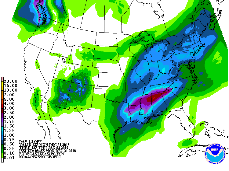
After a very wet 2018, 2019 will start out on a wet note in much of the Eastern United States as yet another area of low pressure heads towards the Atlantic. More than 4″ of rain is possible in the water-logged East over the next three days.
While the eastern US saw two significant early season snowstorms before the official start of winter, conditions have been mild enough in the I-95 corridor to keep snow out of Washington, DC, Baltimore, MD, Philadelphia, PA, New York City, NY, and Boston, MA. It appears more of the same will occur over the next three days as rain remains the primary precipitation type.
Snow is expected, however, in portions of northern New England as January 2019 rolls in. 6-12″ is possible across the highest terrain of Vermont, New Hampshire, and Maine while plain rain will fall along the southeastern New England coast and the Mid Atlantic coast.
Looking into the future, extended guidance suggests no significant cold weather outbreak or snow threat in the eastern U.S. for at least the next 10 days.